Ward-Thomas Museum
![]()

Early Landowners
Ward — Thomas
Museum
Home of the Niles Historical Society
503 Brown Street Niles, Ohio 44446
Click here to become a Niles Historical Society Member or to renew your membership
Click on any photograph to view a larger image, click on image again to zoom into photograph.
|
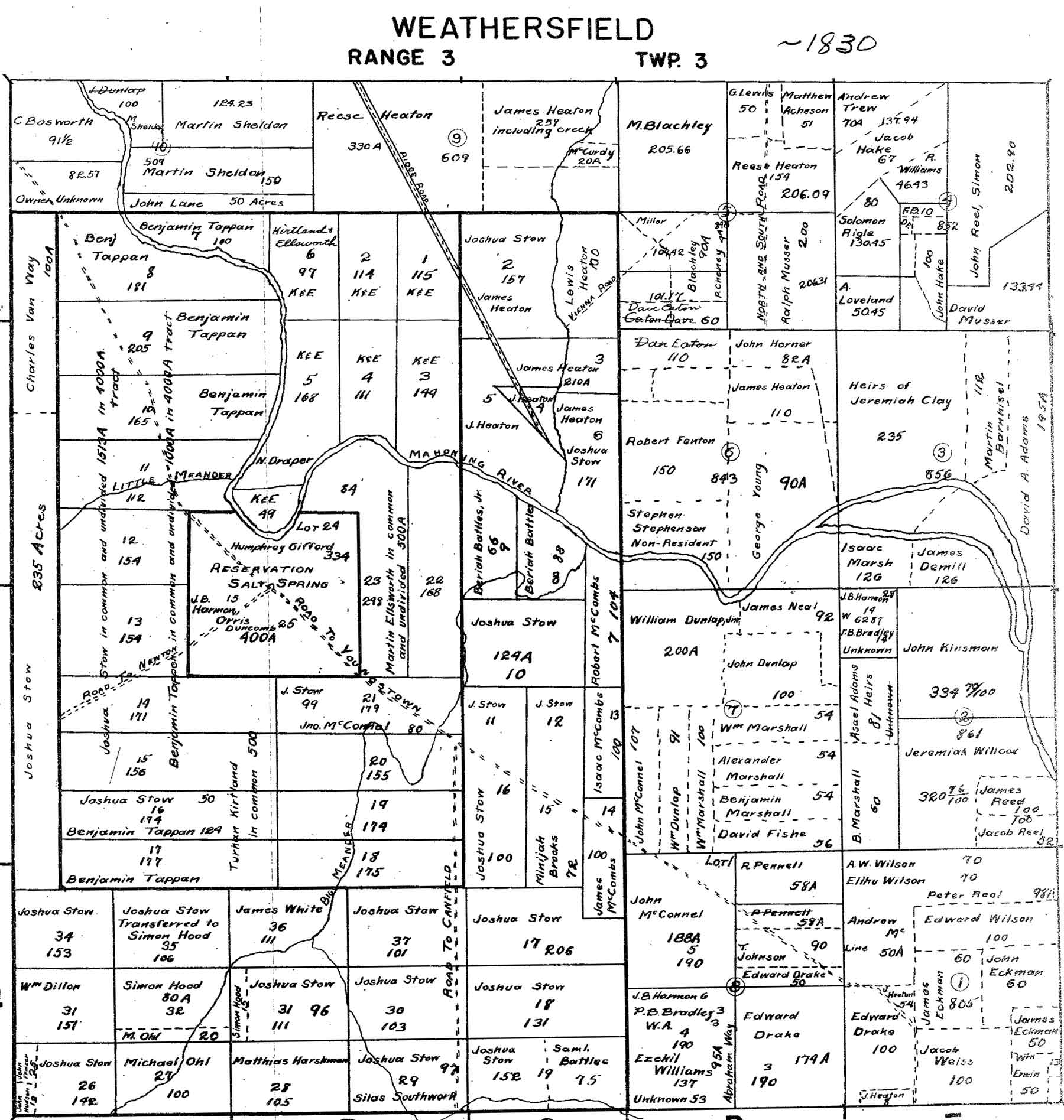
1830 Weathersfield Map of Property Owners.
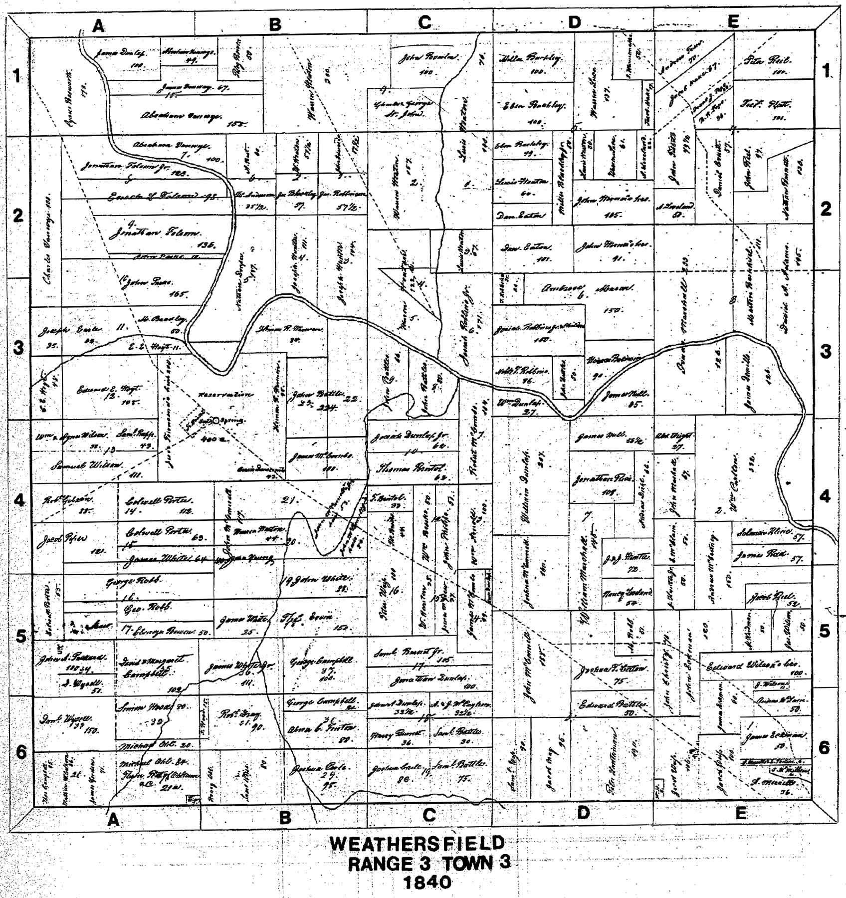
1840 Weathersfield Map of Property
Owners. |
Maps
Reveal Early Land Owners Here The land on the south side of the river, west of the point where the Meander Creek joins the river was the property of Bariah Battles, while that lying east of the confluence of the two streams and south of the river was owned by Robert McCombs. At the end of the Heaton period in 1840, few changes to the land ownership outside the village had taken place. The original James Heaton possessions were now in the hands of his son, Warren Heaton; the Joshua Stow land east of the creek and north of the river had been purchased by Josiah Robbins Sr., and the Bariah Battles property was recorded in the name of his heir, John Battles.
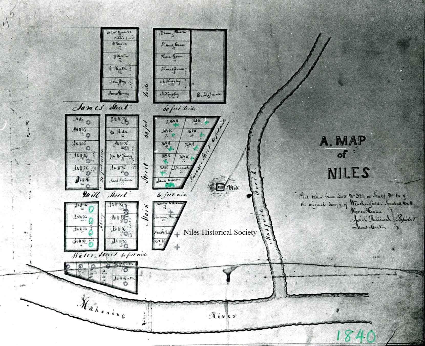
Weathersfield Township Map featuring Niles. |
| |
|
1840 map of Niles. Of the 54 lots platted in 1834, they were listed as follows: 23 lots, James and Warren Heaton, 12 lots - Heaton and Robbins, Lot 18 - M. Rider, 20 - William McKinley Sr., 22 - Jacob Robinson, 29 - Ambrose Mason, 31 - James Heaton, 37 - J. Frederick, 42 - David Bowell, 43 and 44 - A. Kingsley, 45,46 and 47 - Thomas Evans, 49- school grounds, 48,50,51 and 52- Warren Heaton, 53 - John Dray, and 54 - James Dempsey. PO1.665 |
In the village plat of 1837, there were fifty-four lots recorded, twenty-nine of which were owned by James Heaton and his son, Warren, and twelve more were jointly held by Heaton and Robbins. The remaining lots were recorded in the names of Thomas Evans, A. Kingsley, John Dray, James Dempsey, J. Frederick, Ambrose Mason, David Bowell, Jacob Robeson, M. Rider, and one lot, that is now occupied by the McKinley Savings and Loan Company, by William McKinley, Sr. That there were fifty-four lots in the first plat by no means indicates that there were fifty-four dwellings. Most of the lots were vacant, there being but thirteen recorded property owners. Outside the village plat, however, there were probably workmen’s cabins along the creek, and in addition, farms scattered throughout the vicinity. But with the exception of the farm clearings,
Niles town in 1834 must be imagined as a diminutive settlement
with the forest pressing in on all sides almost to the present
business district, and with pioneer conditions on living and travel
still prevailing. |
| |
|
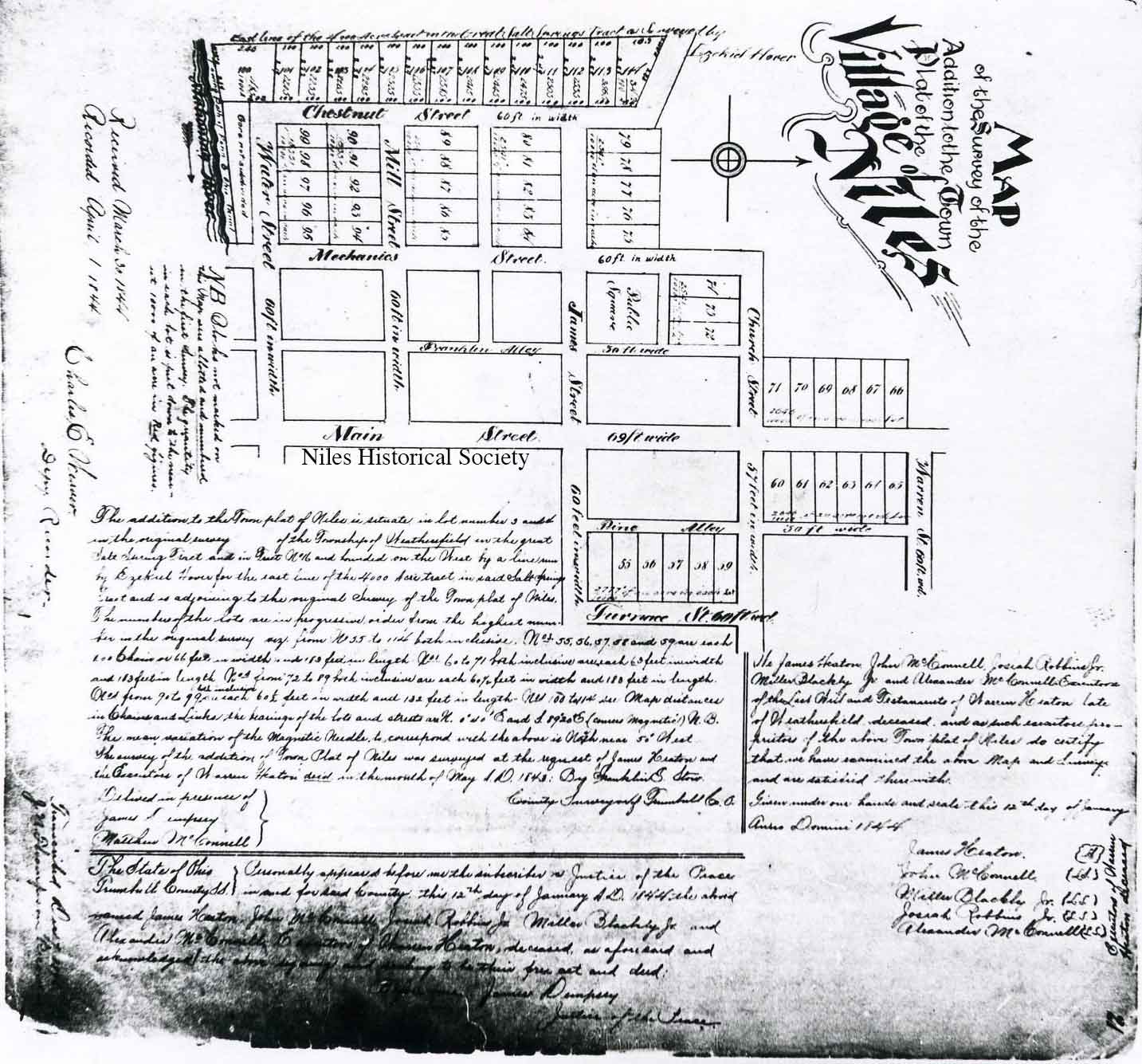
An 1847 map of Niles showing the lots platted downtown by James Heaton. PO1.652 |
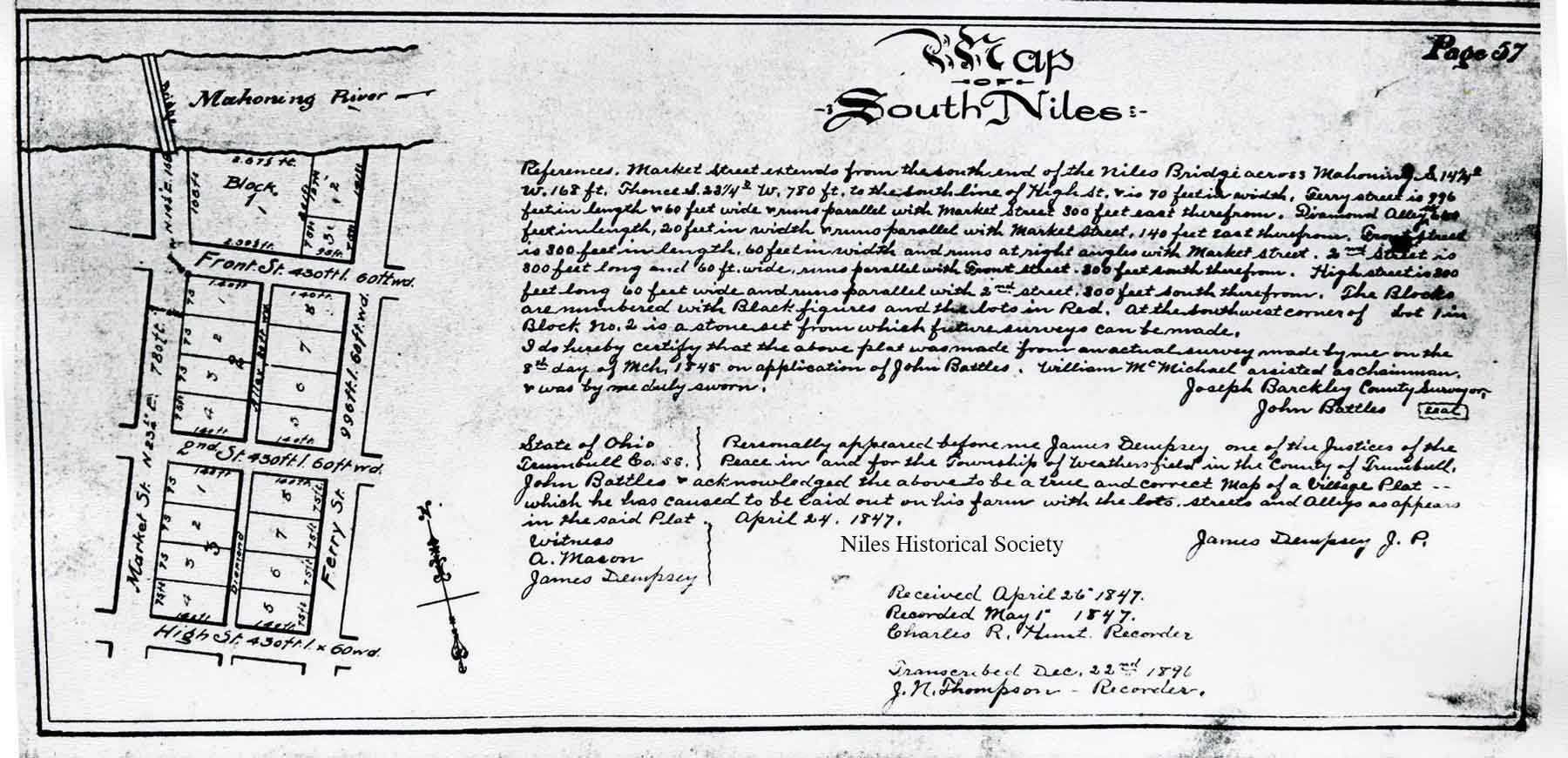
1847 map of south Niles. |
| |
|
|
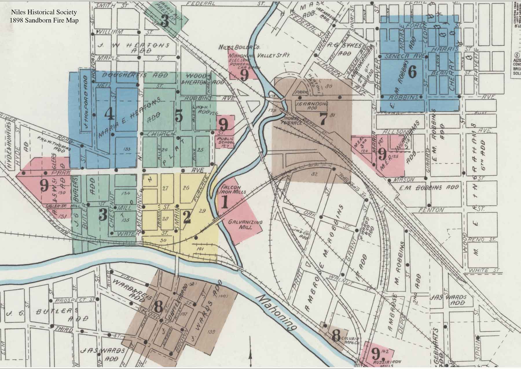
Niles Sandborn Fire Insurance Map, 1898.
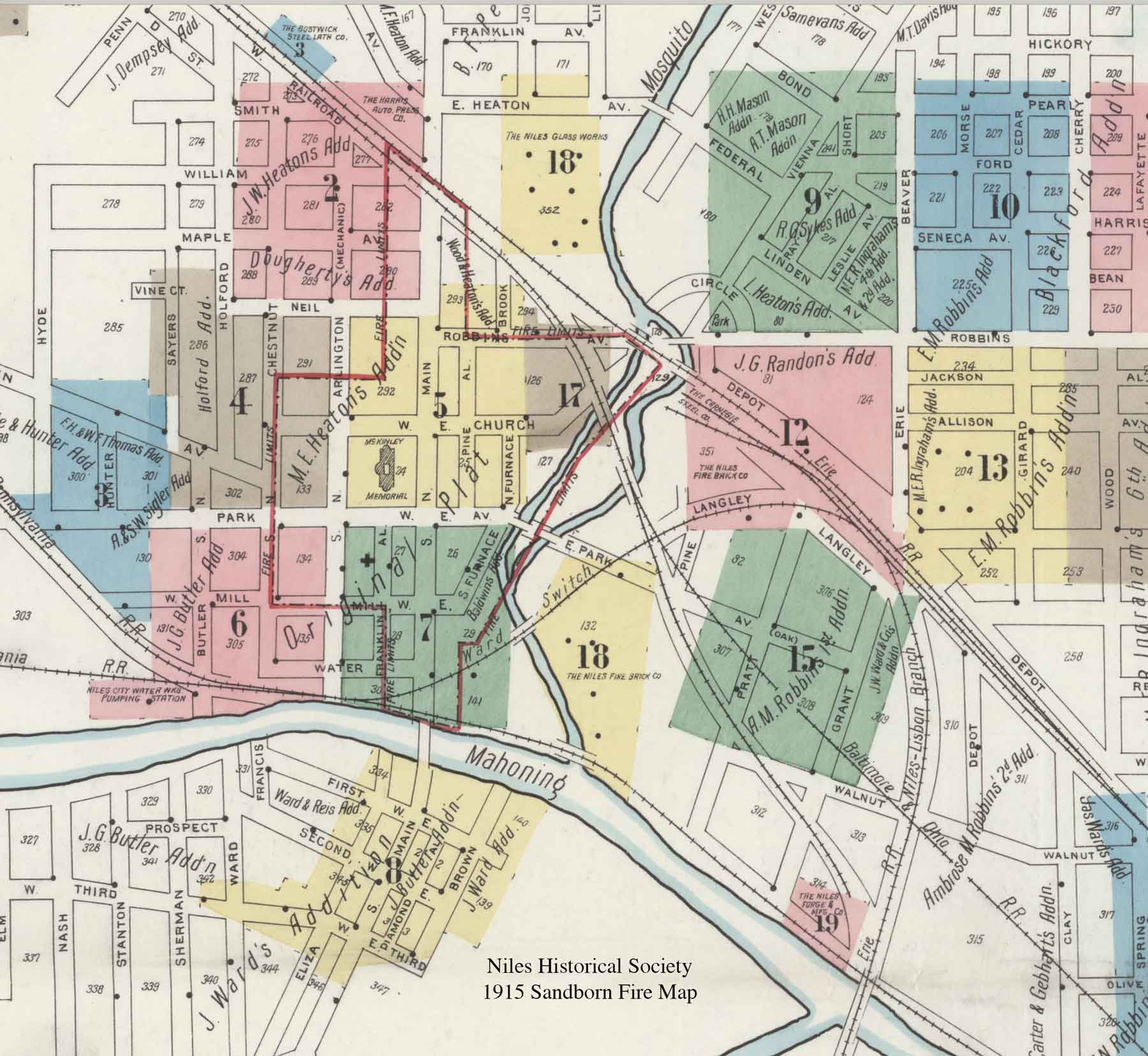
Niles Sandborn Fire Insurance Map, 1915. |
A Sanborn fire map is a sheet map or atlas map depicting the built environment of a city. A fire insurance map thoroughly describes buildings, land use, and transportation infrastructure, unlike a street map. Fire insurance became an essential thing in the 19th century. Historic photographs, city directories, and birds-eye images (aerial photographs and maps) each reveal important information about historic buildings. Historic photographs depict the historic form, construction, and architecture of a building; city directories document the address, occupancy, and function of a building; and birds-eye images illustrate the spatial organization of structures, cityscapes, and landscapes. But is there a historic document that informs historians with the knowledge gathered separately from historic photographs, city directories, and birds-eye images? While Sanborn Fire Insurance maps were originally intended to aid the assessment of fire risk by insurance companies, modern historians study these maps for their unrivalled documentation of the historical addresses, sizes, functions, construction materials, and geospatial distribution of structures. This information together, as demonstrated, is akin to using historic photographs, city directories, and birds-eye images in tandem. Viewing the 1898 and 1915 Sandborn Fire Insurance maps of downtown Niles will show thw additions to the area’s business and industrial growth. The 1915 map has a red outline indicating the original plats as laid out by James Heaton in 1834. |
|
|
|