Ward-Thomas Museum
![]()

The
History of the Intersection of Main Street and
James Street now called Park Avenue.
Ward — Thomas
Museum
Home of the Niles Historical Society
503 Brown Street Niles, Ohio 44446
Click here to become a Niles Historical Society Member or to renew your membership
Click on any photograph to view a larger image, click on image again to zoom into photograph.
|
|
|
|
| |
||
|
Early Street Maps From Centennial
Club History, 1934 |
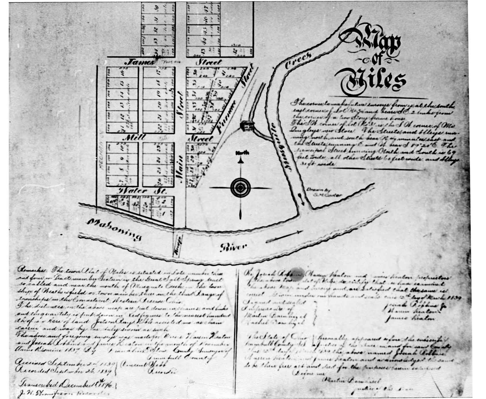
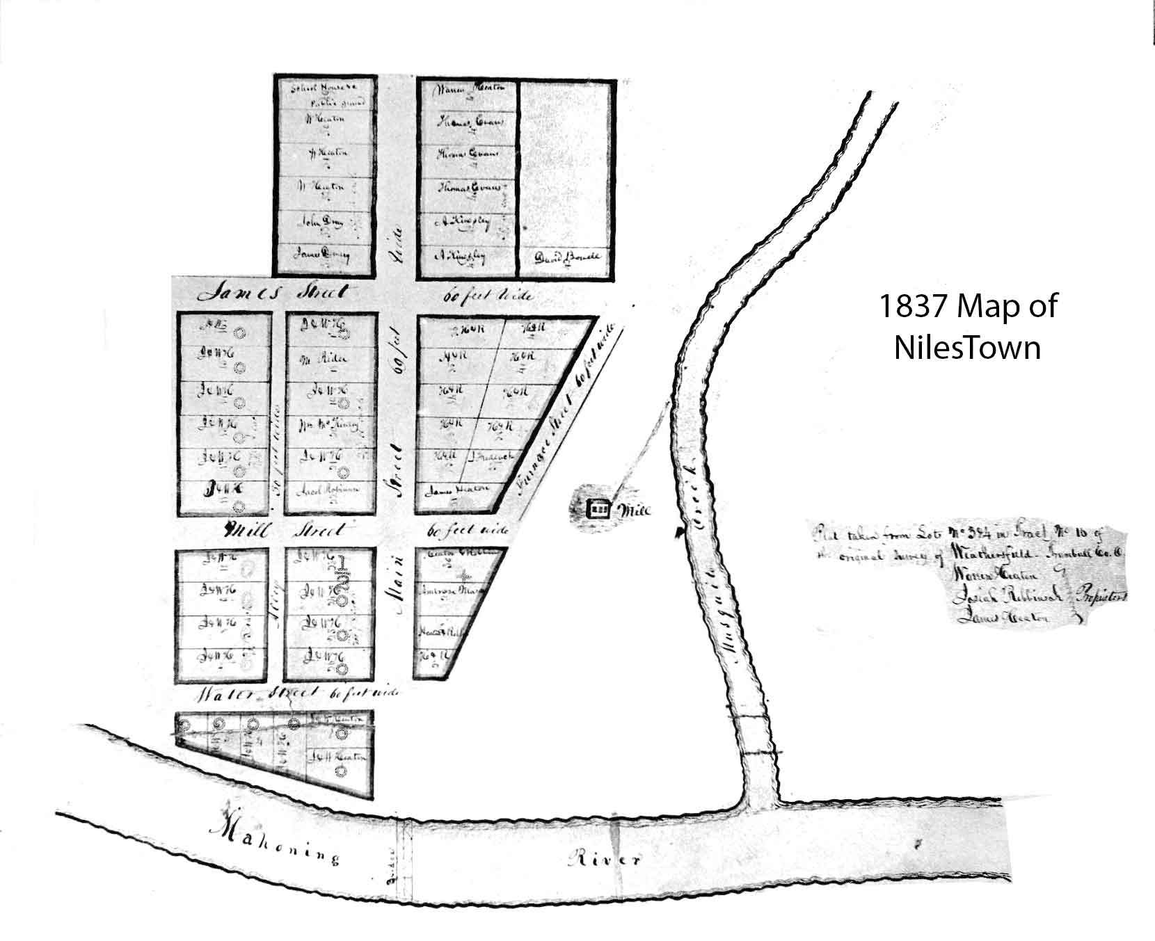
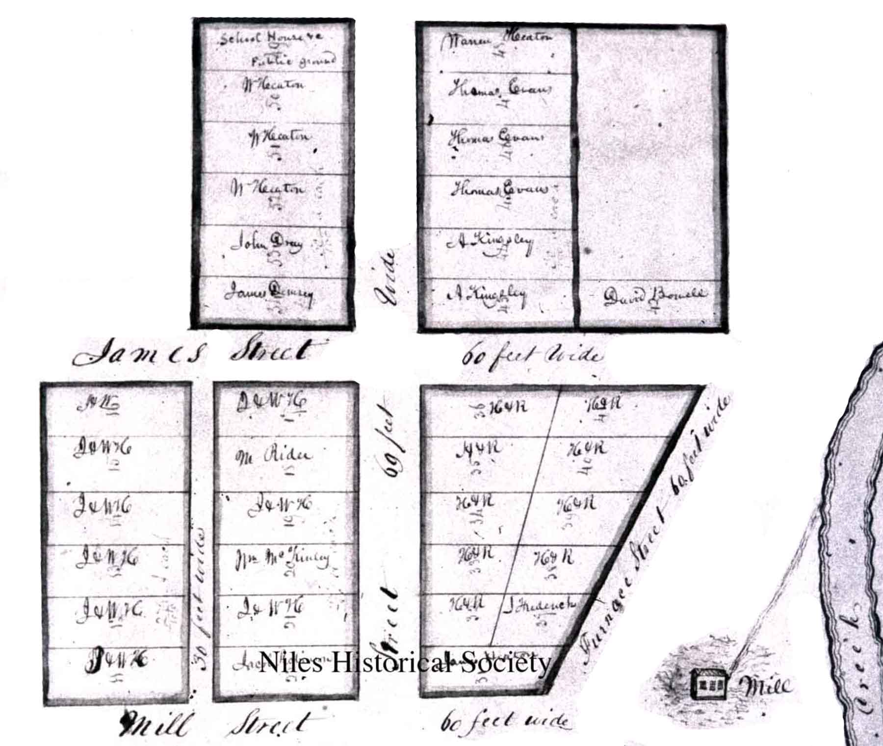
In the village plat of 1837, there were fifty-four lots recorded, twenty-nine of which were owned by James Heaton and his son, Warren, and twelve more were jointly held by Heaton and Robbins. The remaining lots were recorded in the names of Thomas Evans, A. Kingsley, John Dray, James Dempsey, J. Frederick, Ambrose Mason, David Bowell, Jacob Robeson, M. Rider, and one lot, that is now the McKinley Research Center, by William McKinley, Sr. That there were fifty-four lots in the first plat by no means indicates that there were fifty-four dwellings. Most of the lots were vacant, there being but thirteen recorded property owners. PO1.665 |
Some of the streets bore different names then and until much later, Main Street and Water Street were as now, but Park Avenue was James Street until after 1900 and extended east only to State Street until after 1900. State Street was Mill Street as it led directly to the gristmill(and Furnace Street due to the mills along the Mahoning River), and Arlington Street was Mechanic Street. The four lots defining the intersection of Main and James Streets were owned by James Dempsey, A. Kingsley, James Heaton and Heaton and Robbins. PO1.665 close-up |
| History
of the buildings located at the north-east corner of the Main
Street and Park Avenue intersection. |
||
|
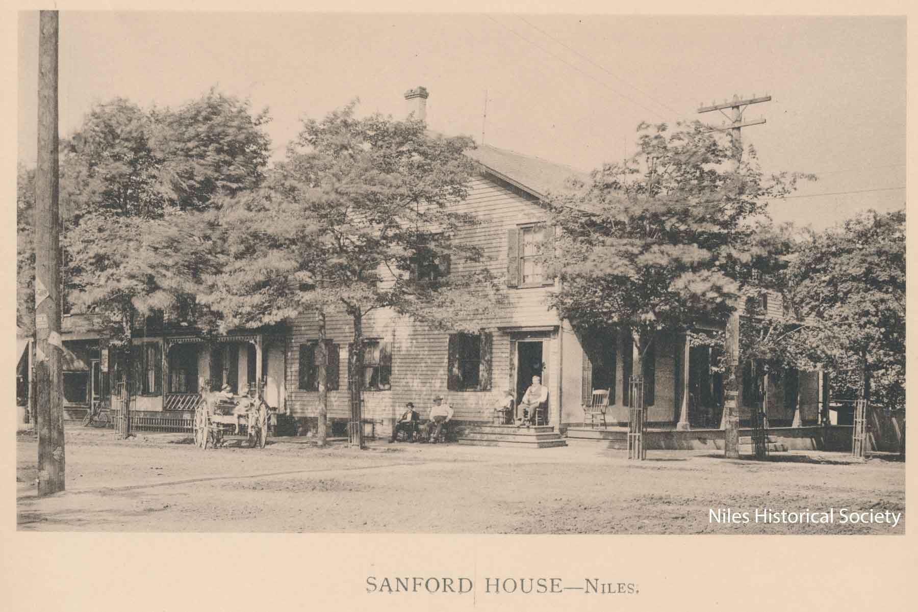
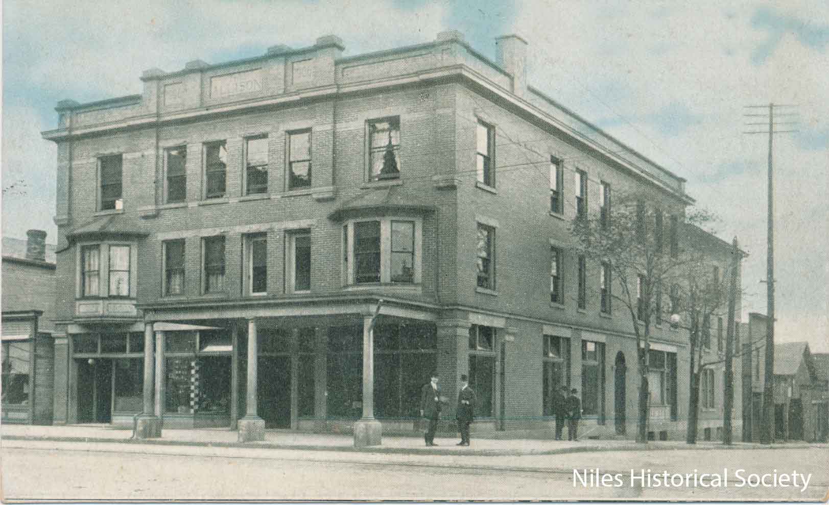
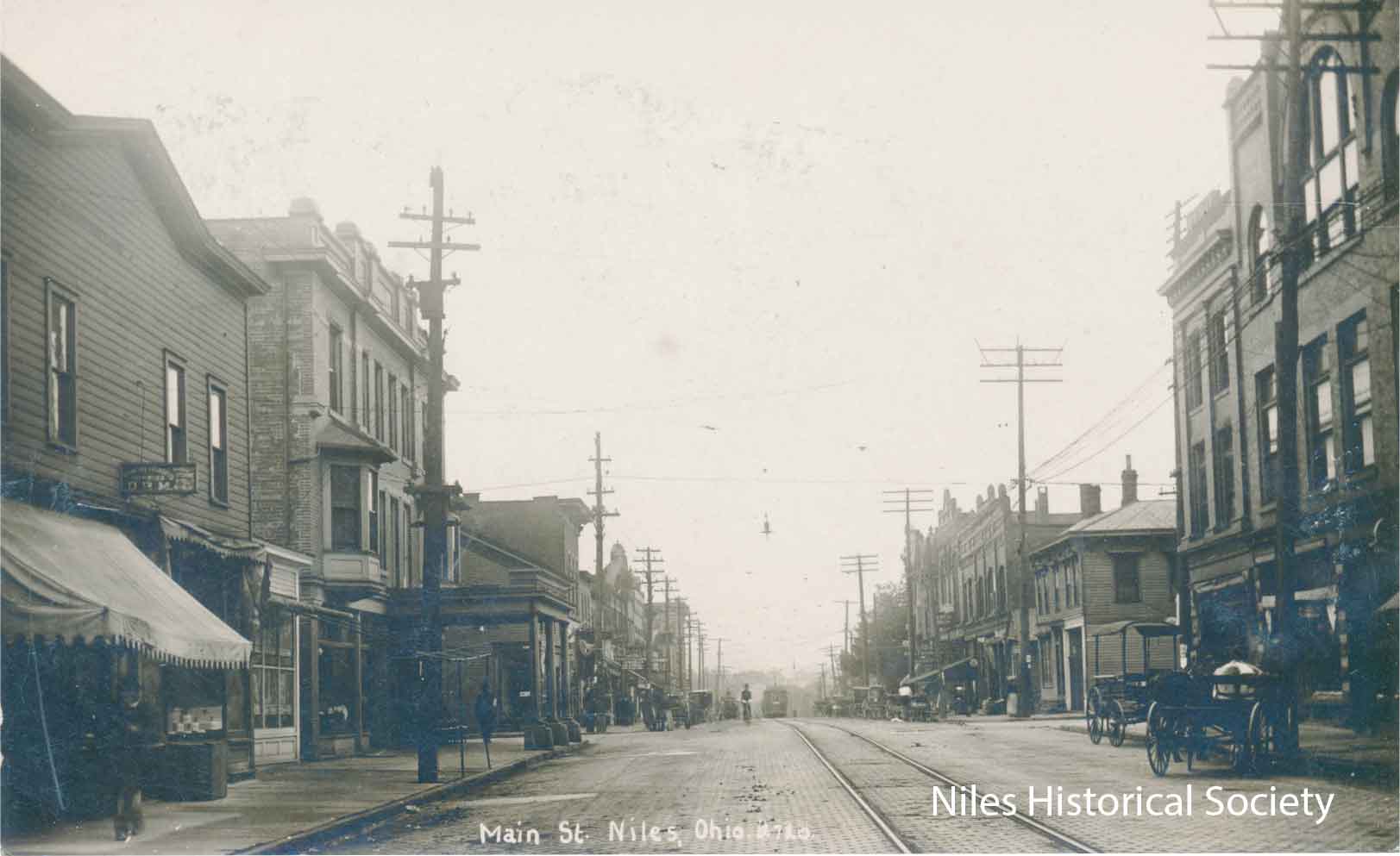
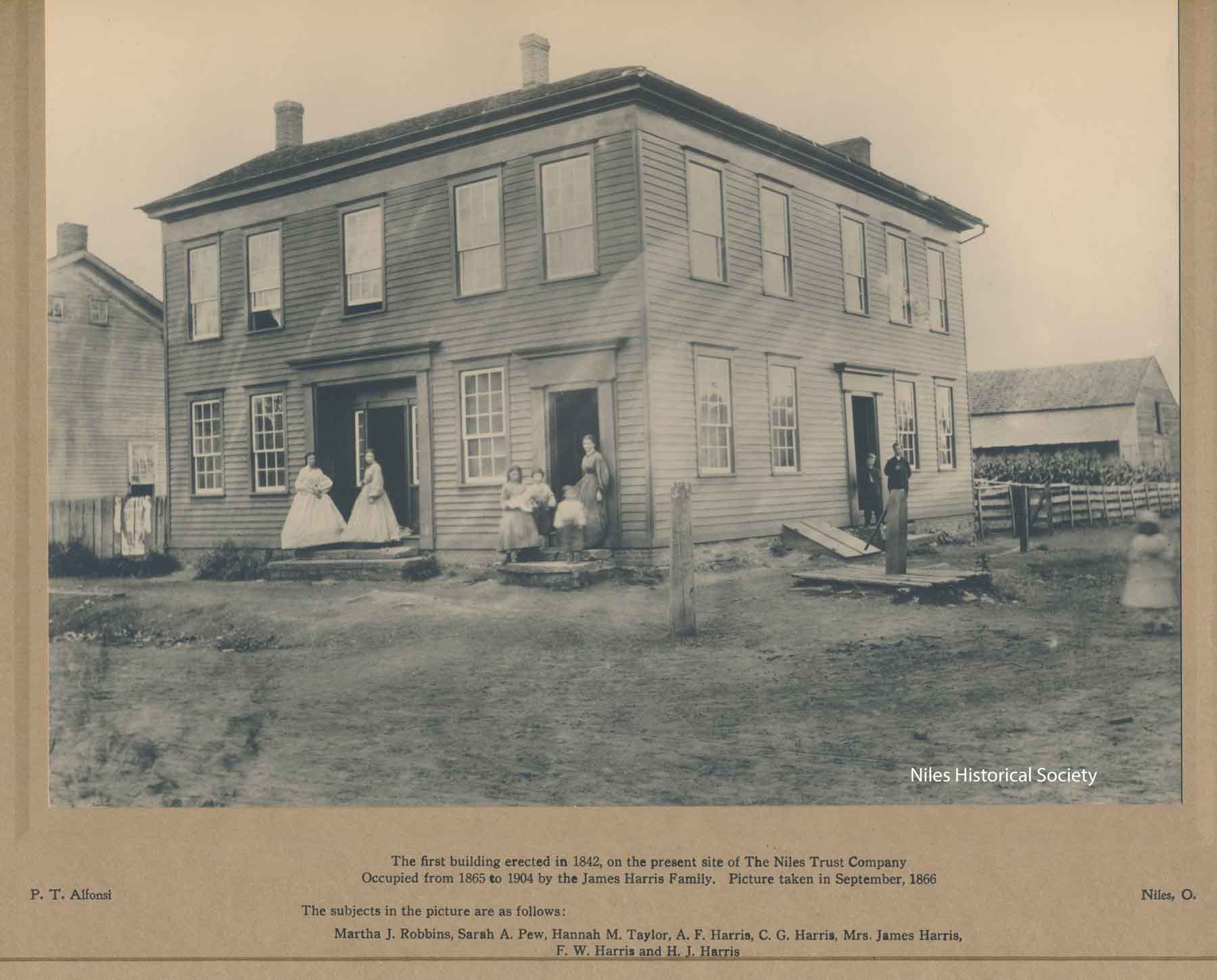
About 1836, James Dempsey built the first hotel on the lot originally owned by A. Kingsley, on the north-east corner of North Main and James Street(later renamed East Park Avenue) in downtown Niles. The proprietor was Jacob Robinson. In 1867, L.W. Sandford purchased this property and renamed it The Sandford House. The Allison Hotel, built on the site of the Sanford House in 1904, had its formal opening in 1905. |
The intersection of Main Street and Park Avenue about 1907-1908. After the street had been paved in 1897, except for the building of the Allison Hotel in 1905, the downtown remained relatively unchanged until the completion of the Memorial in 1917 and the Dollar Bank in 1918. |
In the foreground is the Allison Hotel, later named the Heaton Hotel around 1930 and finally the Antler Hotel. The house across James Street(East Park Avenue) on the southeast corner was the old Ward Residence built in the early 1840s. After the Wards moved to their more elaborate home on Brown Street in 1862, known today as The Ward-Thomas Museum today, this house was used as a hotel for many years until it was torn down in 1918 for the Dollar Bank Building. Farmers National Bank is located here. PO1.905 |
| |
||
|
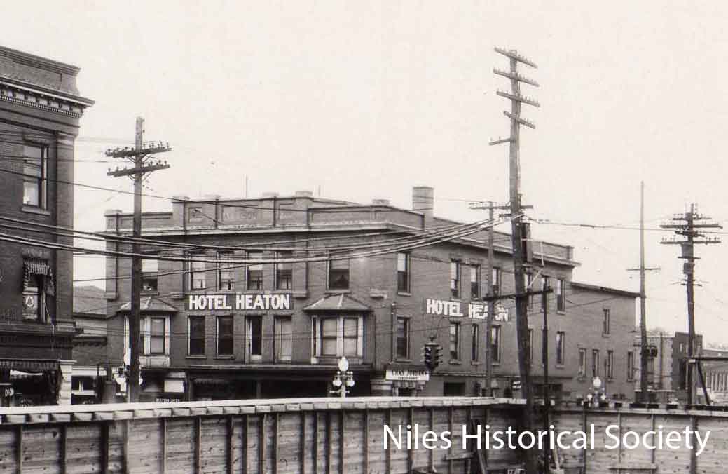
The Allison Hotel was renamed Hotel Heaton, after the founder of the village, sometime between 1905 and 1930. This 1930 view of the Heaton Hotel is from the construction site of the Niles Bank Building on the south-west corner of Main Street and Park Avenue.PO1.21 |
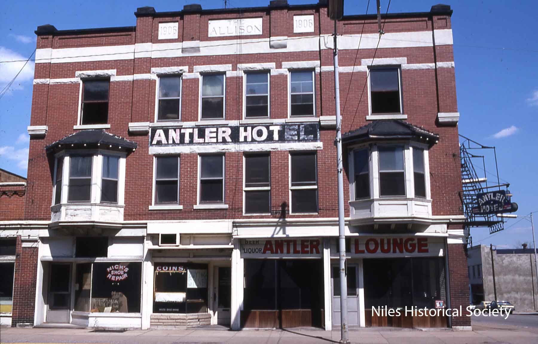
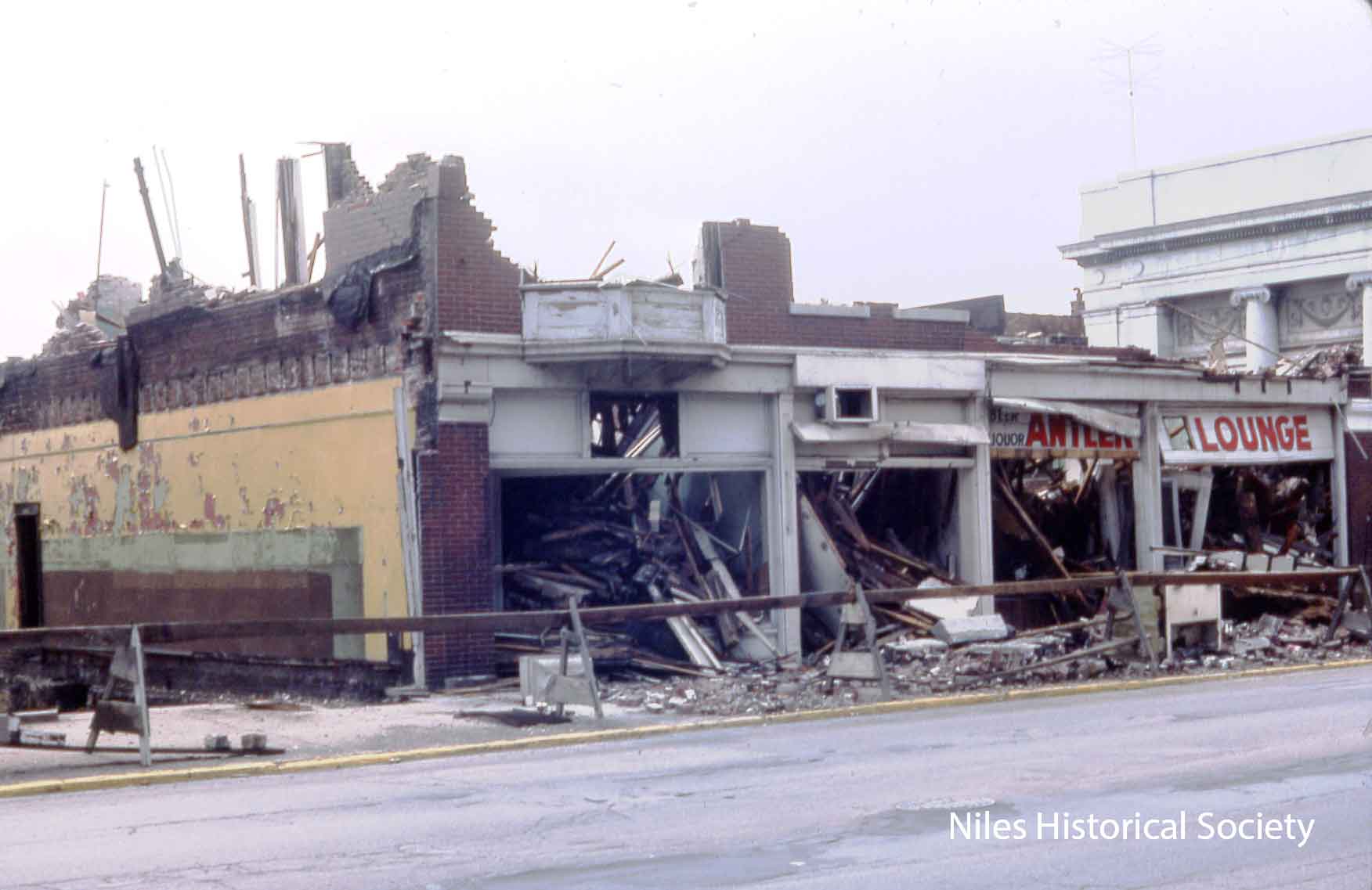
The Antler Hotel as it appeared
before urban renewal in 1976. A coin and shoe repair shop were part of the ground floor businesses. S01.497 |
The Heaton Hotel was renamed the Antler Hotel until it and adjoining buildings were demolished during urban renewal in 1976. Most of the original downtown buildings were torn down during urban renewal. S11.134 |
| |
||
|
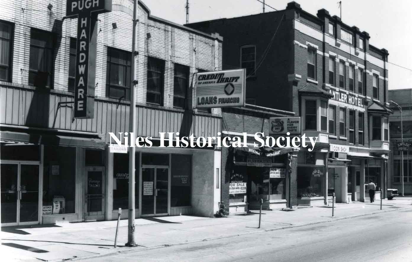
The Antler Hotel and adjoining buildings on North Main Street before urban renewal in 1976. |
The same location after new construction after urban renewal in 1976. |
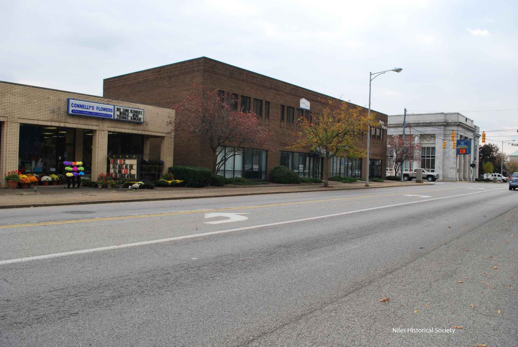
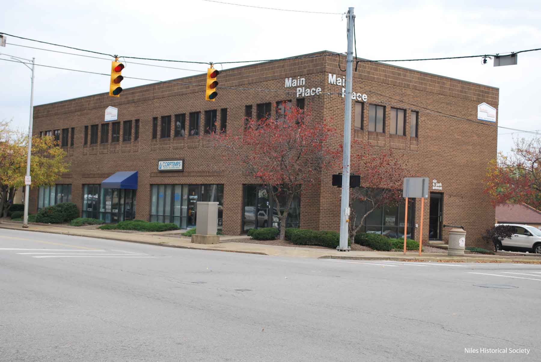
After the Antler Hotel was razed in 1976, new construction resulted in a new all-brick building named Main Place. The Main Place Building first and second floors are occupied by several small businesses; a dance studio and a Subway sandwich shop, among others (2018). |
| History
of the buildings located at the south-east corner of the Main
Street and Park Avenue intersection. |
||
|
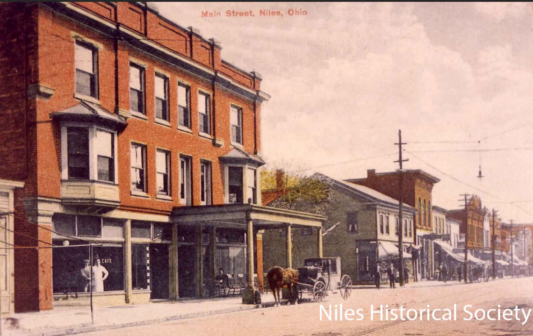
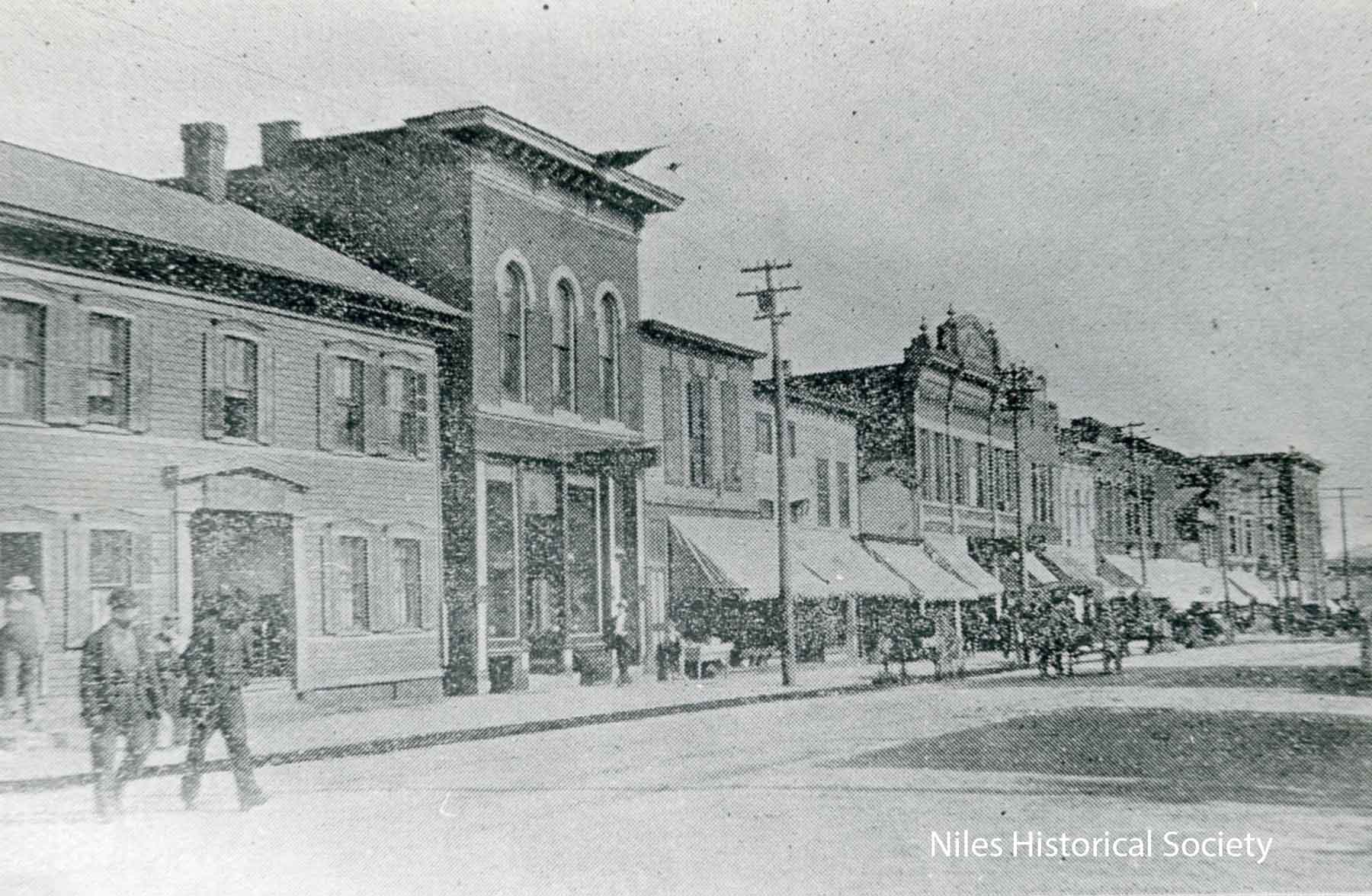
This 1908 view of Main Street shows the Allison Hotel, the Ward Residence now a hotel, The Harris House, and on the northwest corner I.O.O.F building built in 1905 and Swaney Building built in 1906 that would become Calvin’s Drug store in 1914. |
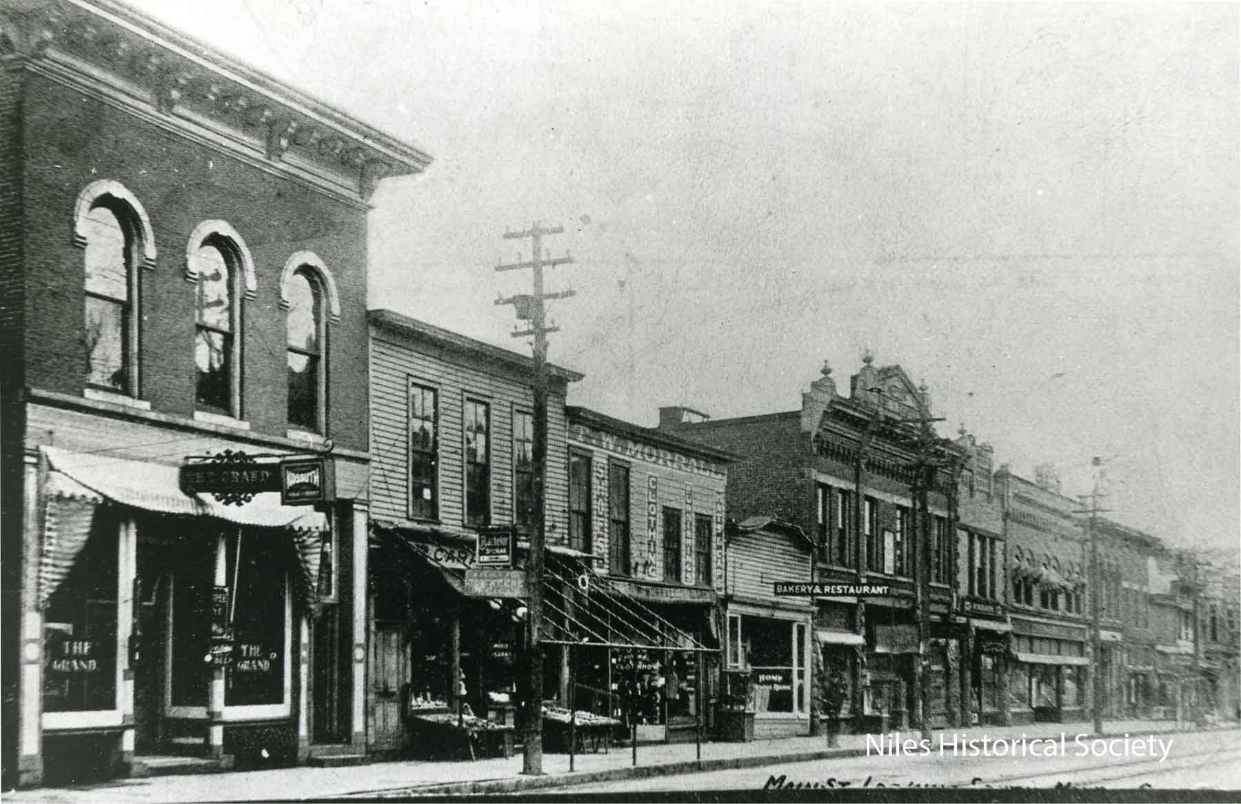
This picture was taken about 1905. Closer view of the Ward residence on the south-east corner of Main Street and Park Avenue. “The Grand” dominates the block. Carmella’s had opened their Ice Cream Parlor next to it. Later, Morral’s Clothing
Store and the Bakery and Restaurant would be replaced with brick
buildings. The Armstrong-Morral Building would become the Ideal
Department Store and the Wagstaff Building, Ragazzo’s
Men’s Shop. |
Closer view of the buildings on the east side of South Main Street. See building descriptions to the left. The Crandon Building built in
1904 became Hoffman’s Store the following year. It burned
down in 1962, marking the decline of downtown Niles. |
| |
||
|
This picture was taken about 1905. “The Grand” dominates the block. Carmella’s had opened their Ice Cream Parlor next to it. Later, Morral’s Clothing Store and the Bakery and Restaurant would be replaced with brick buildings. The Armstrong-Morral Building would become the Ideal Department Store and the Wagstaff Building, Ragazzo’s Men’s Shop. The Crandon Building built in 1904 became Hoffman’s Store the following year. It burned down in 1962, marking the decline of downtown Niles.
|
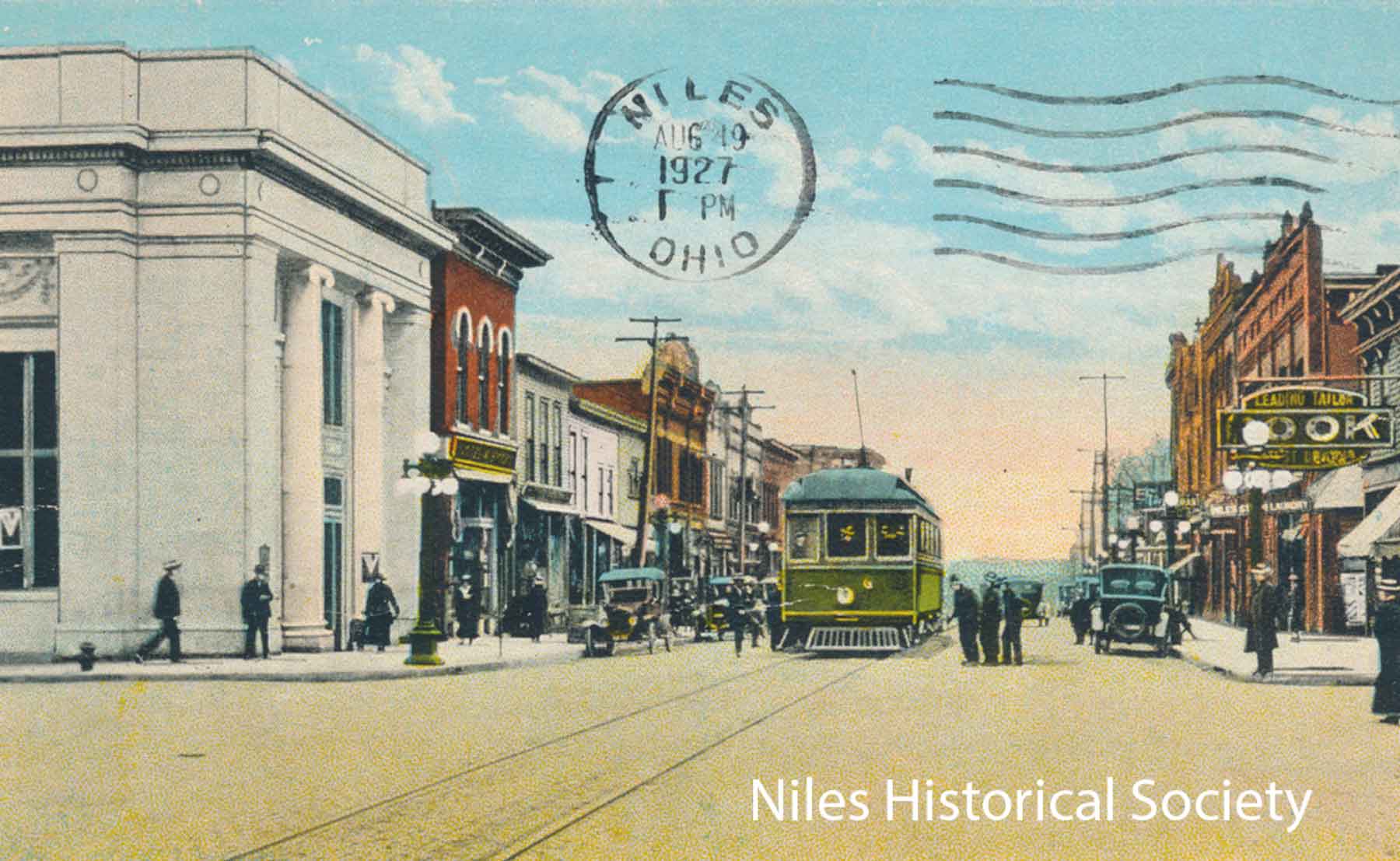
This postcard, dated August 19, 1927, shows the Dollar Bank building and several brick buildings that were built before 1900 on the east side of South Main Street. |
South Main Street August 1, The building. where Caramella’s Ice Cream Parlor was located was torn down in the 1960’s. The next two buildings replaced the wooden W. Morrall store and the bakery were built about 1920. The new Theis drug store can be seen, built in 1976 as part of the urban renewal. In the foreground is the Dollar Savings Bank, built on that corner in 1918. PO1.39 |
| History
of the buildings located at the south-west corner of the Main
Street and Park Avenue intersection. |
||
|
|
|
|
| |
||
|
|
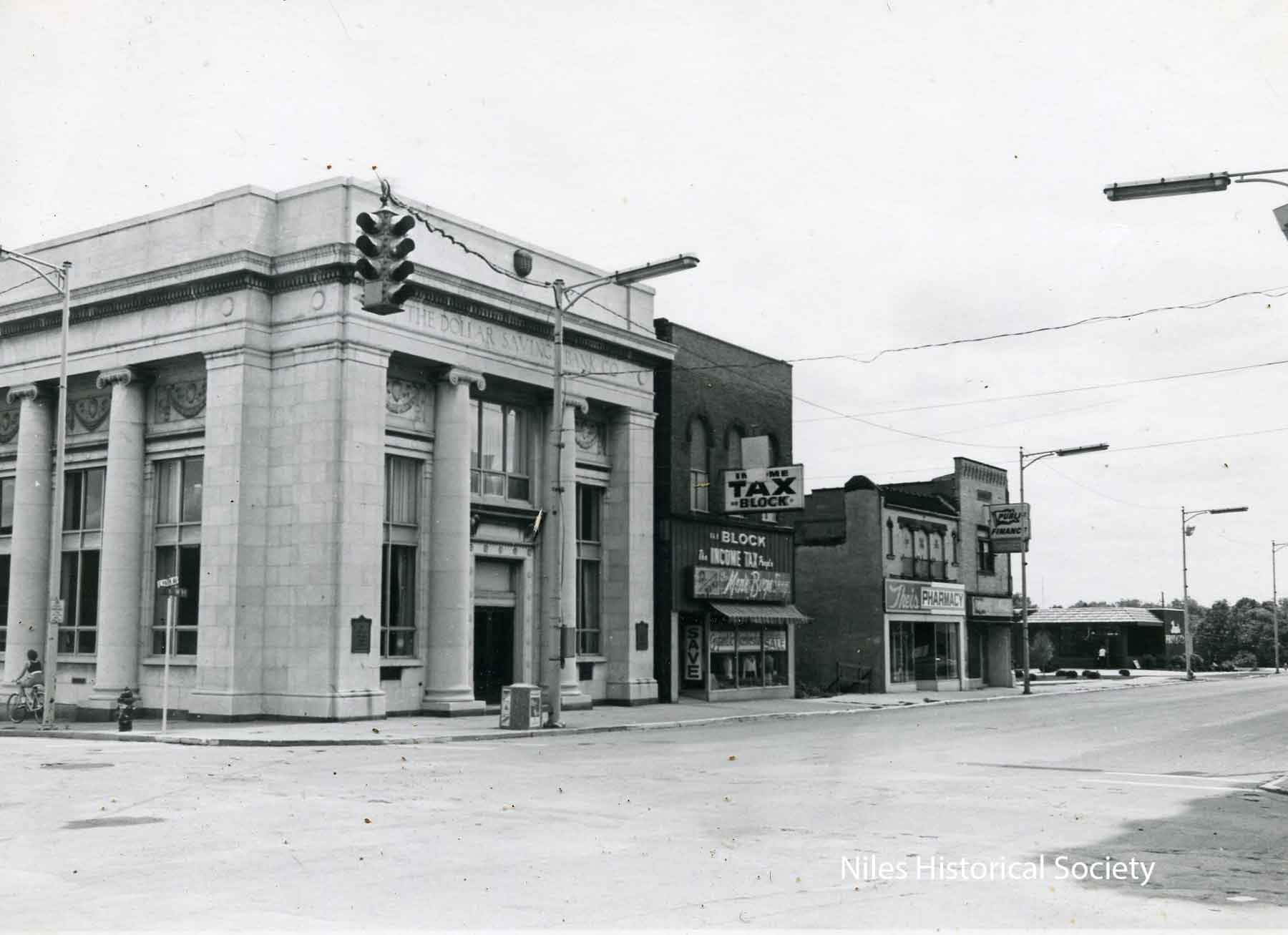
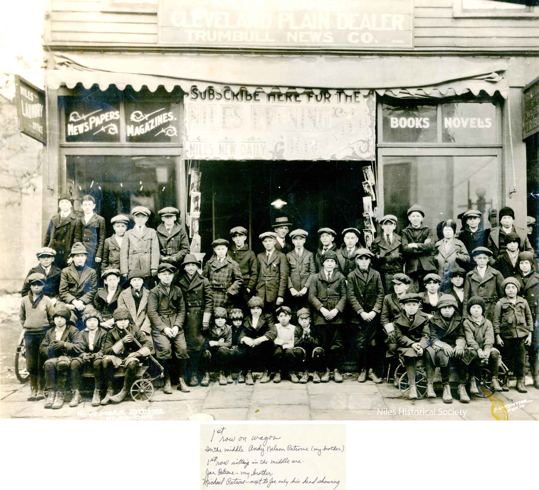
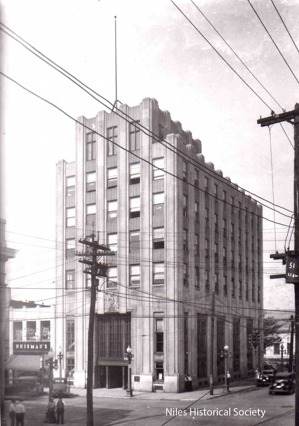
Above left: On the plat originally owned by James Ward, located on the corner of South Main and West Park Avenue the Harris house was built in 1842. From 1842 - 1865 it served as a hotel. From 1865 - 1905 it was the Harris residence. From 1905 to 1929 business were located in the building. This structure was demolished in August 1929 prior to the construction of the Niles tallest building -The Niles Trust Company Bank building. Above center: The house on the left was built in 1842 as a hotel. In 1865 it was purchased by the Harris family who occupied it until 1905. From then until 1920 it was used as a store and warehouse. In 1920, the Harris heirs sold it to the Niles Trust Co. In 1930, The Niles Trust Company Bank building was built on the site. The Lor-a-Lee diner can be seen in the back of the Harris building. Upon construction of the Niles Bank building, the diner was moved to a location opposite of the Wiiliam McKinley Memorial on north Main Street. PO1.226 Above right: November 19, 1922, newspaper delivery boys in front of the newsstand on Main Street with manager William Klatt. Left: The Niles Trust Company Bank building
opened in its new Art Deco building in 1930 in Niles, Ohio,
but closed during the Great Depression when The Niles Trust
Company failed to open its doors on September 28, 1931, with
its deposits of millions of dollars frozen; the building later
became the Niles Professional Building, housing various tenants,
and remains a historic downtown landmark with its original vault
still inside, later marketed for new uses like restaurants or
apartments around 2018. PO1.33 |
|
| History
of the buildings located at the north-west corner of the Main
Street and Park Avenue intersection. |
||
|
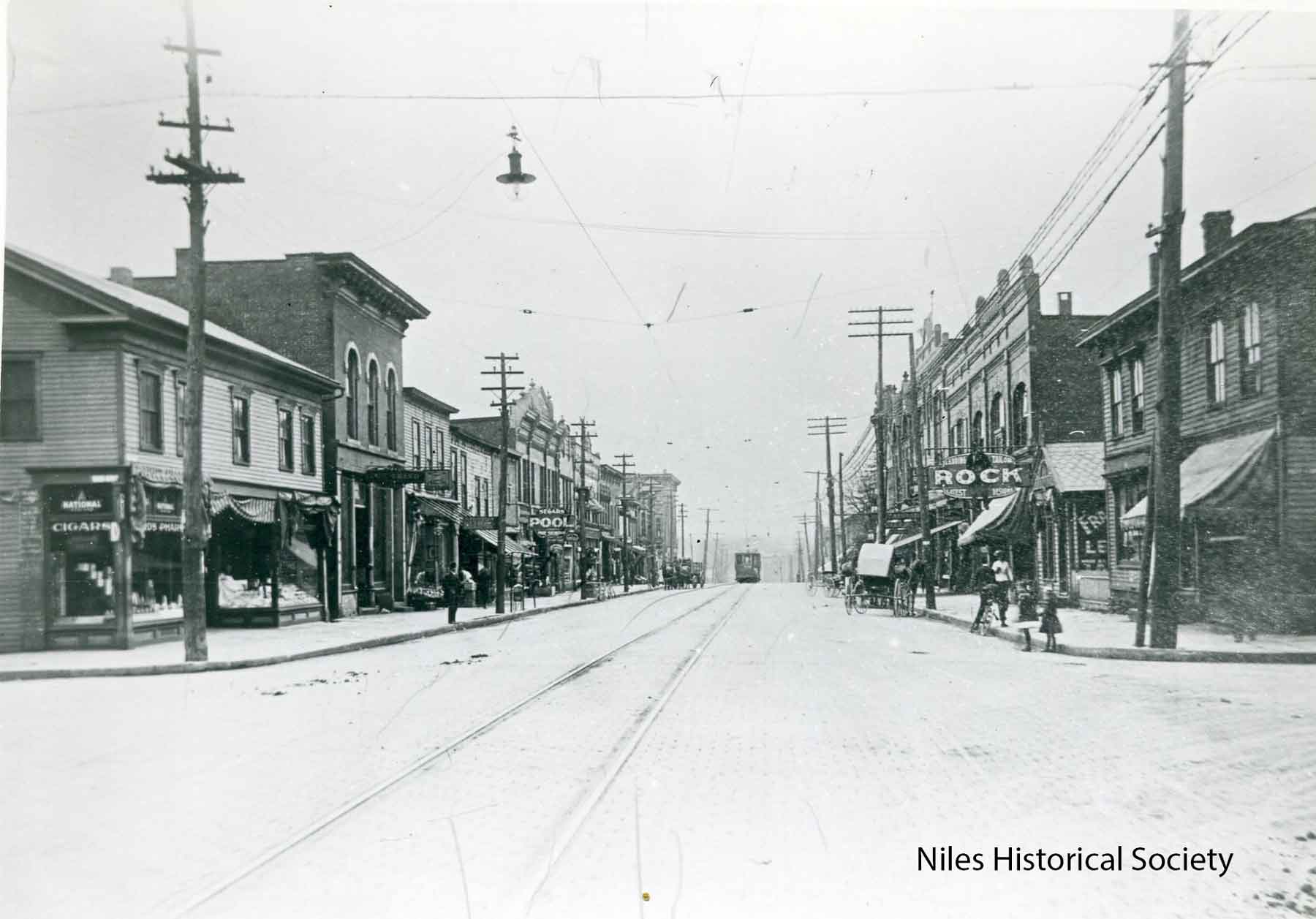
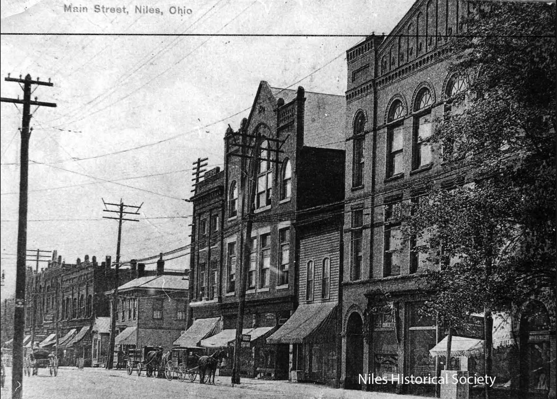
This 1908 view of Main street and West Park Avenue shows the Allison Hotel, the former Ward residence now a hotel,the Harris House and on the northwest corner the IOOF building built in 1905 and the arrow pointing to the Swaney Block built in 1906. The Swaney building would become Calvin's Drug store in 1914. |
Swaney and International Order of Odd Fellows buildings, built between the years of 1904 and 1905, were located on the northwest corner of Park Avenue and Main Street on the lot originally owned by James Dempsey. PO1.223
|
View of North Main Street. ca 1910. The Swaney building would become Calvin's Drug Store in 1914. P11.318 |
The last two buildings that remained on the McKinley Memorial block would be razed in 1990. Since 1917, it has been the intent of the McKinley Memorial Association that the McKinley Memorial and grounds would occupy the entire block between Park Avenue and Church Street except for the site of the First Christian Church on the rear northwest corner of the block. Now, a little more than 70 years later, that intent will soon become a reality. S11.265 |
View of North Main Street, ca 1910. The Swaney building would become Calvin’s Drug store in 1914. This picture of buildings in downtown shows Calvin’s, Odd Fellows Hall, Bakery, large white building with 2 horse drawn buggies in the street. PO1.318 |
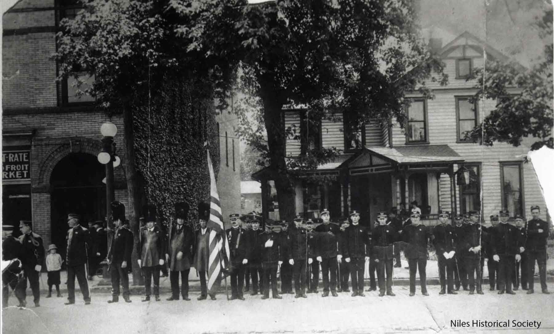
The Knights of Pythias members standing in front of the Wagstaff building which stood north of the Swaney building on the west side of North Main Street where the McKinley Memorial grounds now stand. Note that the house has not yet been removed from the Memorial grounds. |
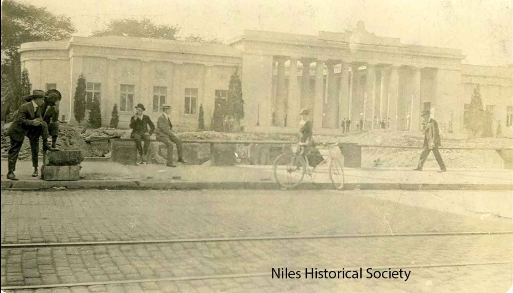
View of North Main Street soon after the McKinley Memorial was built in 1917. All the buildings and houses on the west side of North Main Street were demolished to provide a clear view of the Memorial. Note the trolley tracks on North Main Street. PO1.2029 |
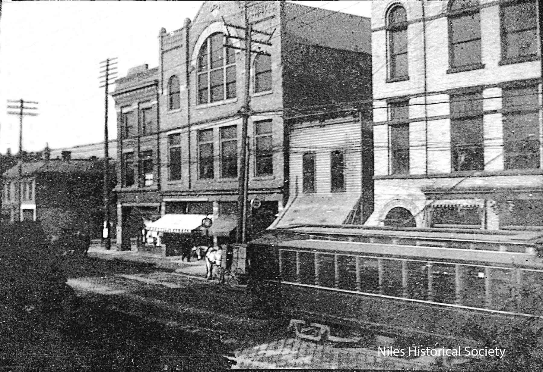
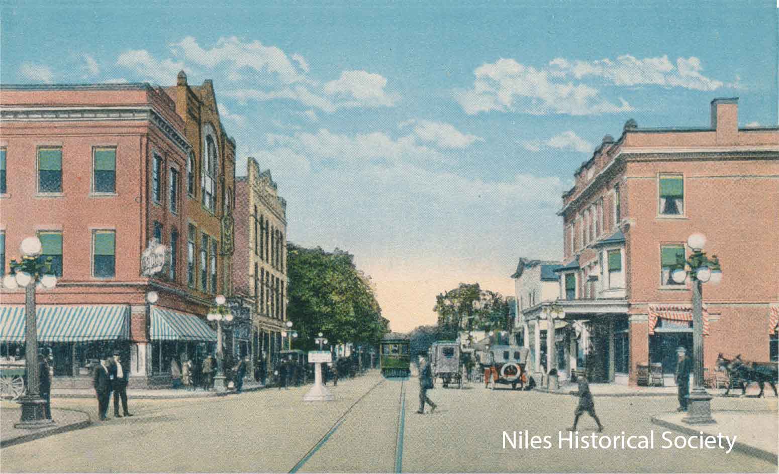
Street view
looking north on Main Street of the Swaney block and Allison Hotel,
ca 1918. The Swaney Block, now gone, is next on the right. The
IOOF building, also gone housed Backenstos Jewelry, Wells Fargo,
and the Singer Sewing Machine Company. |
View of the McKinley Memorial from the corner where the Swaney block and IOOF buildings stood. |
| |
||
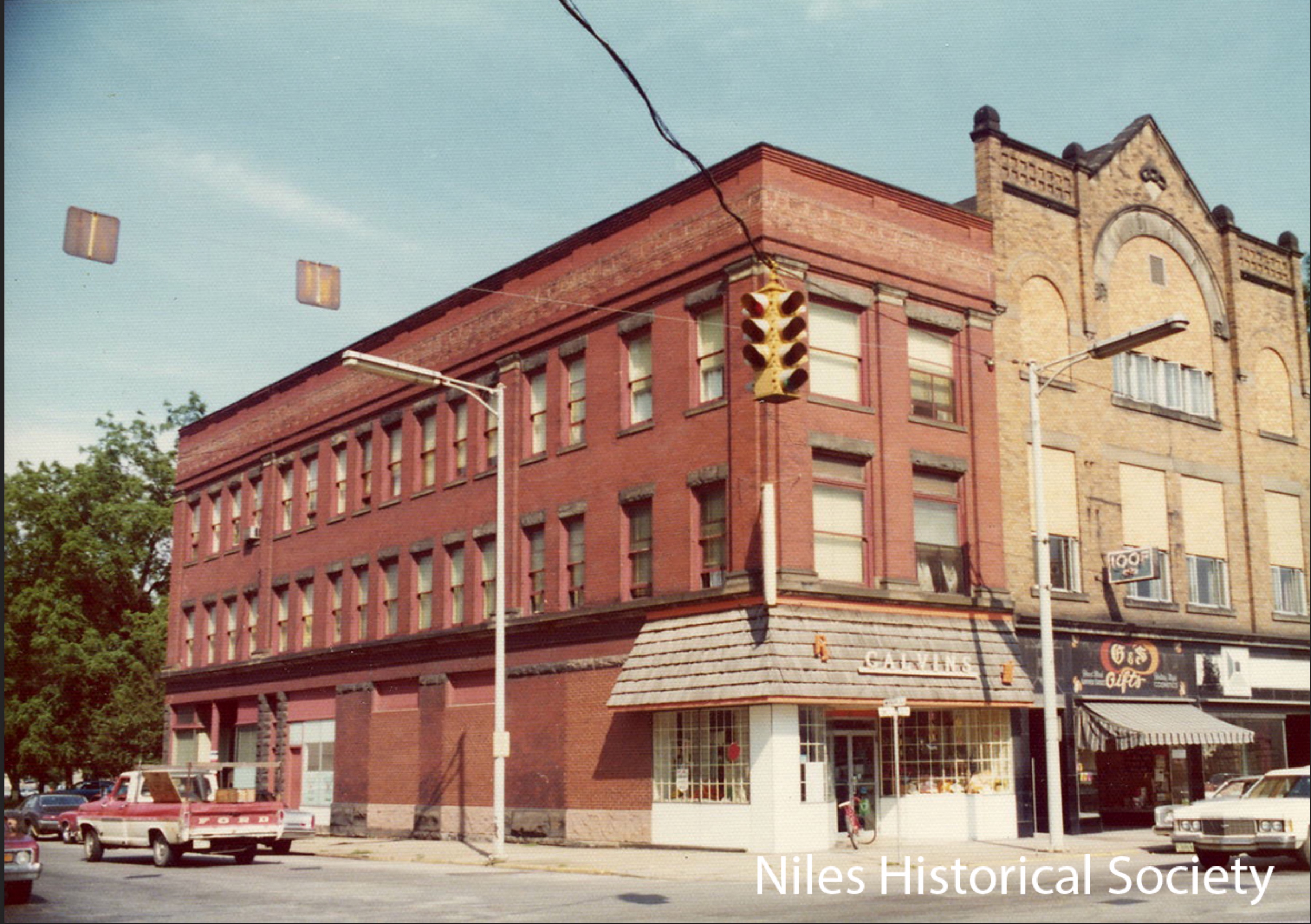 |
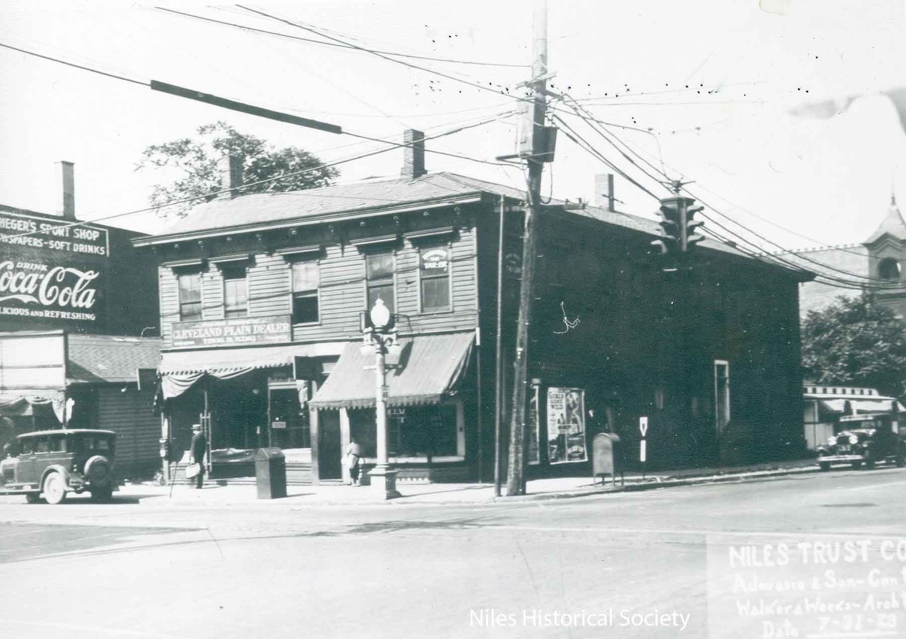
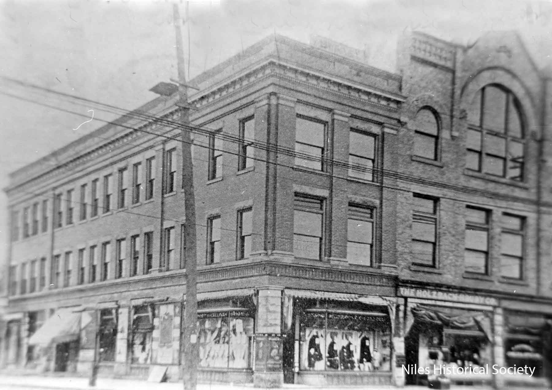
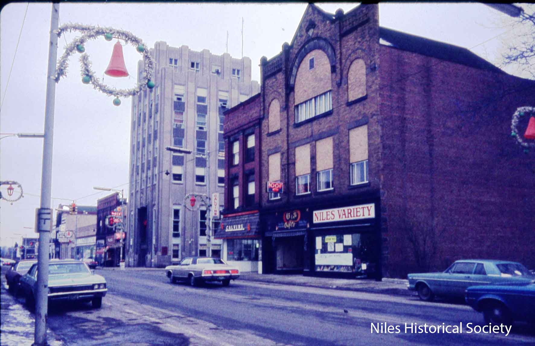
Photo taken of the Swaney Building when it housed Calvin’s Drug Store and the IOOF building, dated 1975, it was located at the northwest corner of Park and Main. The red brick Swaney building, of classical Revival style, originally had a decorative cornice which was marked “Swaney”, but at some time over the years it was removed. When the Swaney brothers built this building, they had had offices on one of the upper floors and there were also fashionable apartments on the above-street-level floors. Originally, the Niles Drug Company, which was owned by the doctors, occupied the first floor of this building, but by 1914, Calvin Drug was the occupant of this store front and remained in this location until the late 1970s. PO1.221 |
|
|
|
||