Ward-Thomas Museum
![]()

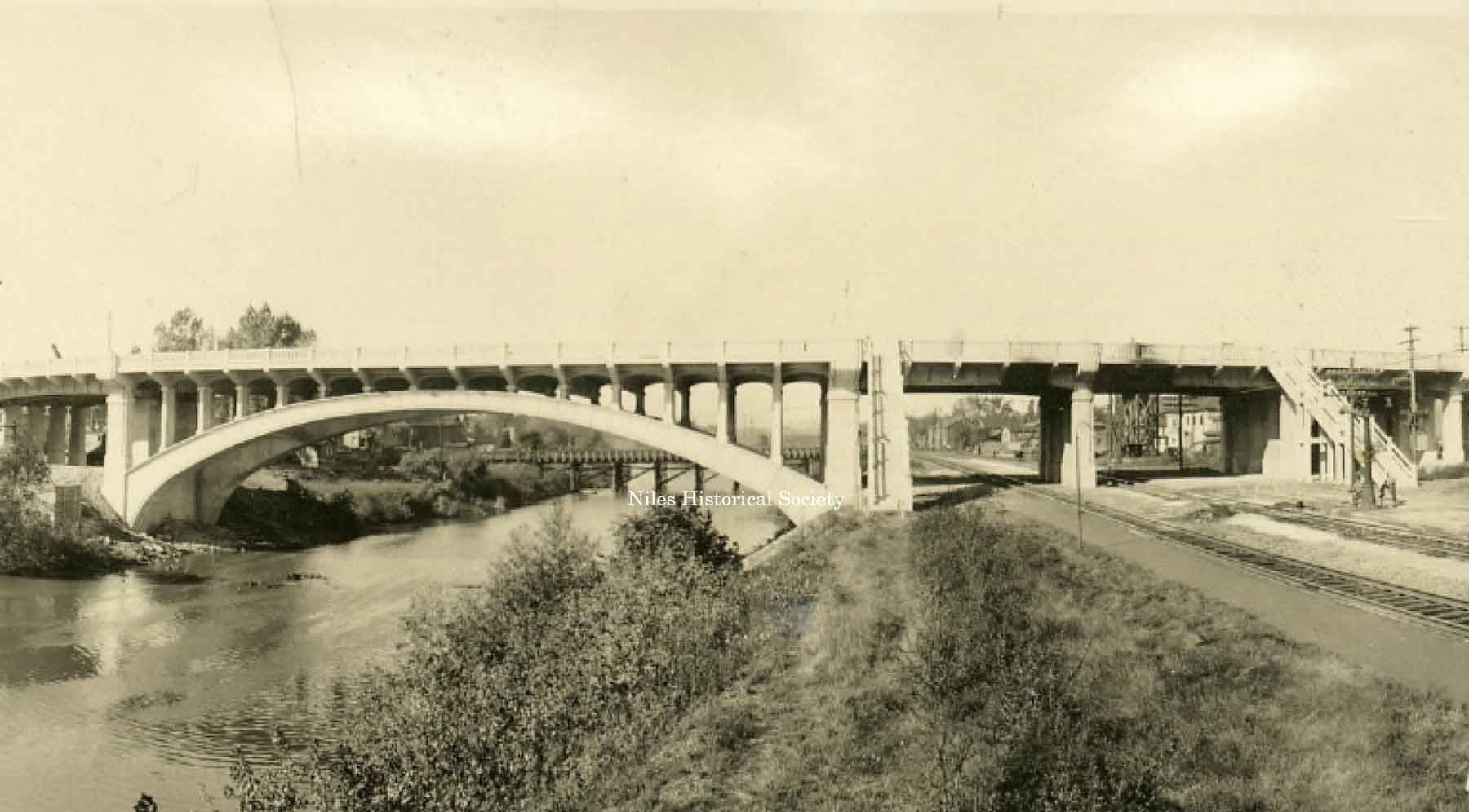
Main Street Viaduct — Niles, Ohio
Ward — Thomas
Museum
Home of the Niles Historical Society
503 Brown Street Niles, Ohio 44446
Click here to become a Niles Historical Society Member or to renew your membership
Click on any photograph to view a larger image, click on image again to zoom into photograph.
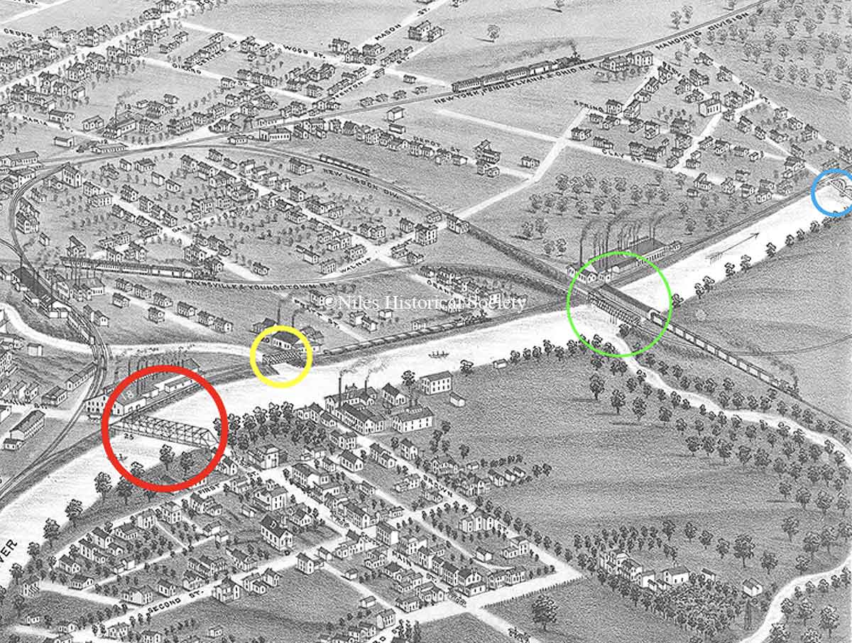 |
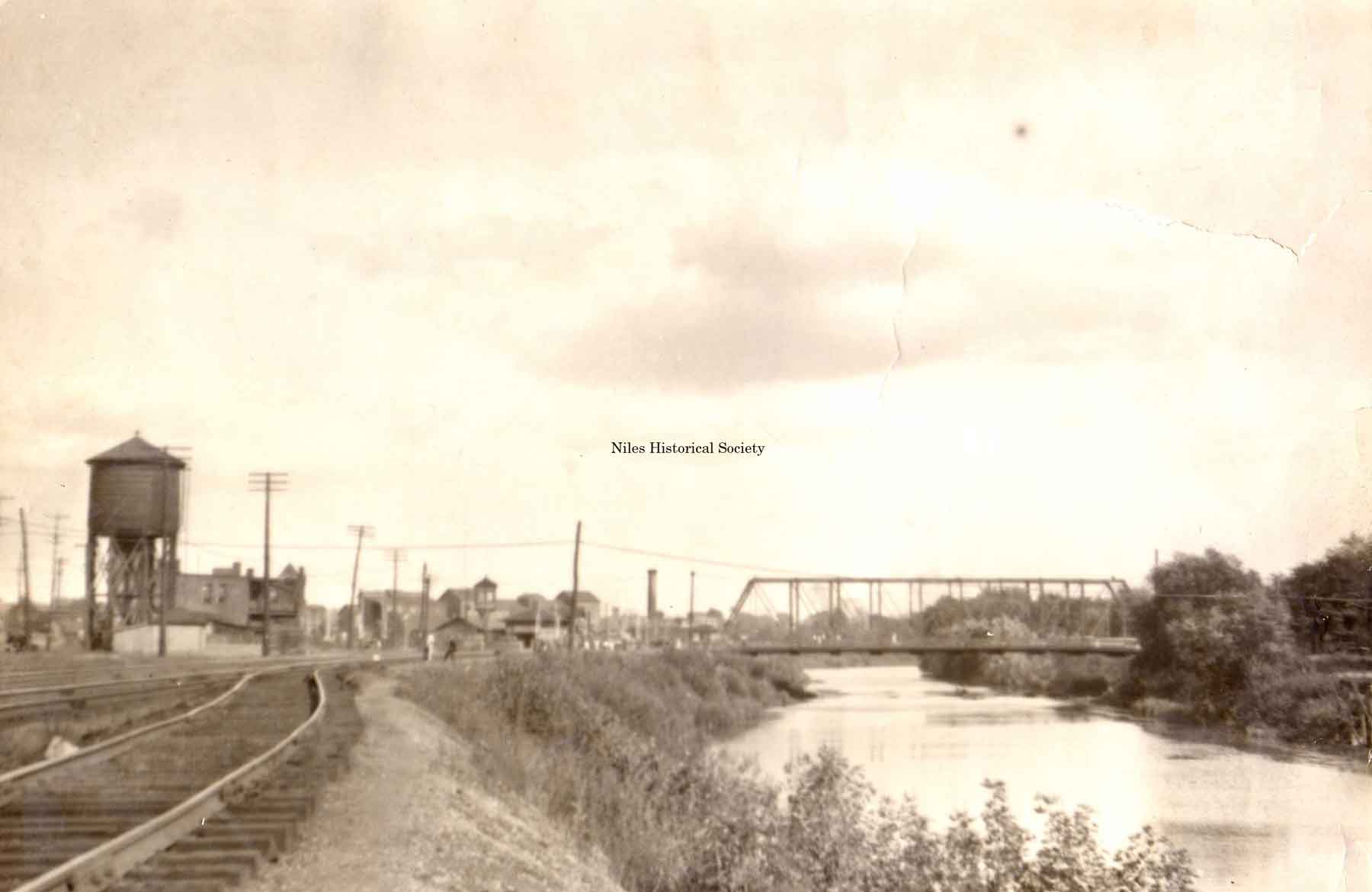
Main Street Viaduct — Niles, Ohio. There are four bridges that cross either the Mahoning River or Mosquito Creek as shown on the 1882 panorama map of Niles. Marked by the red circle is the Iron Bridge that spans the Mahoning River. This bridge provided access between the north and south sides of Niles. |
|
|
PO1.68a
PO1.69 |
PO1.91
|
The
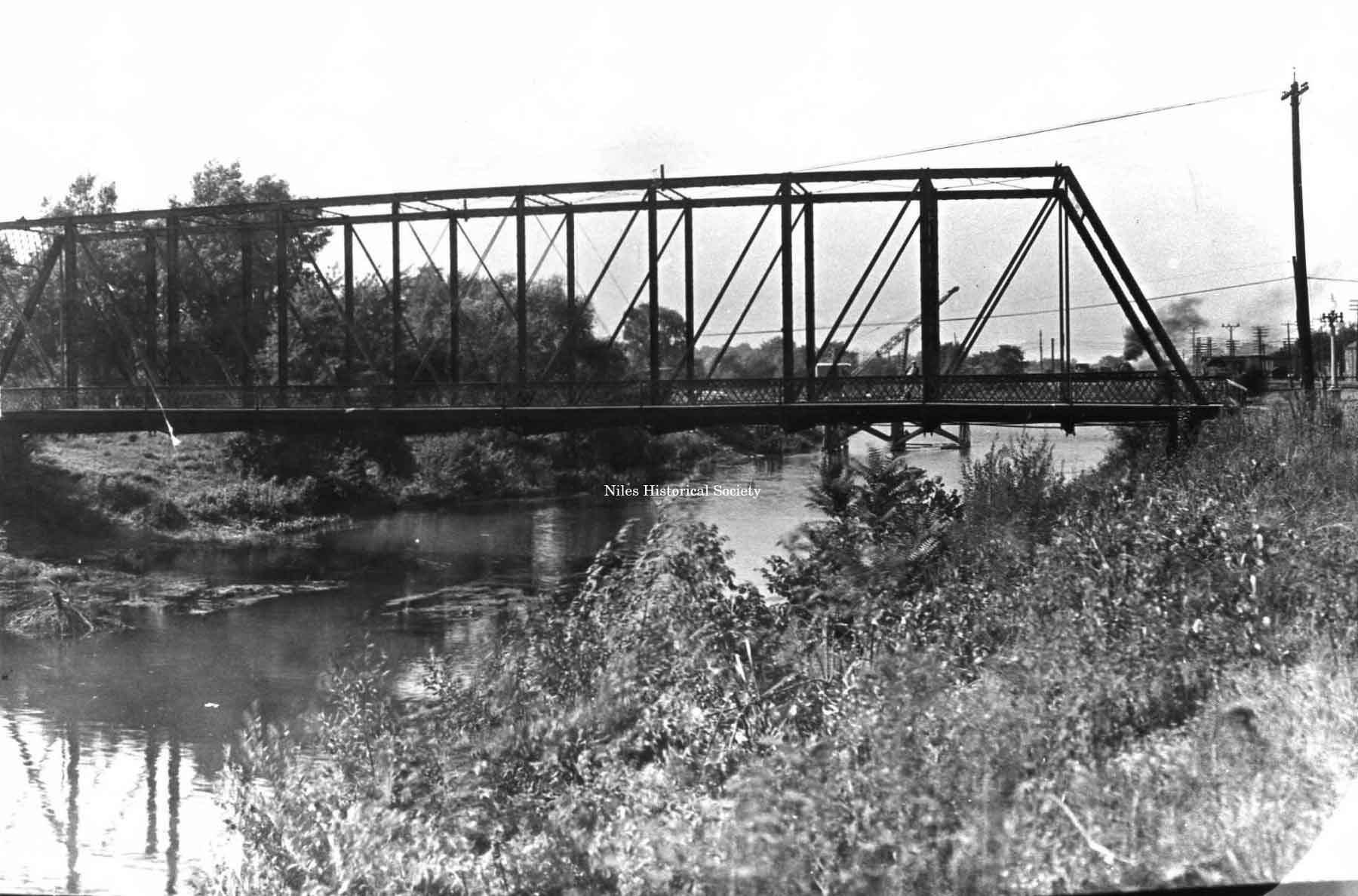
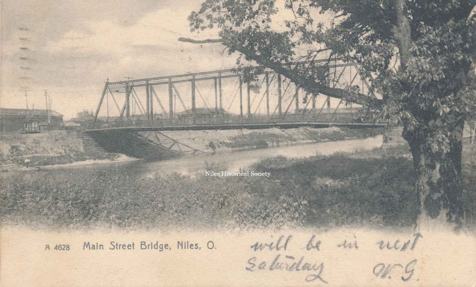
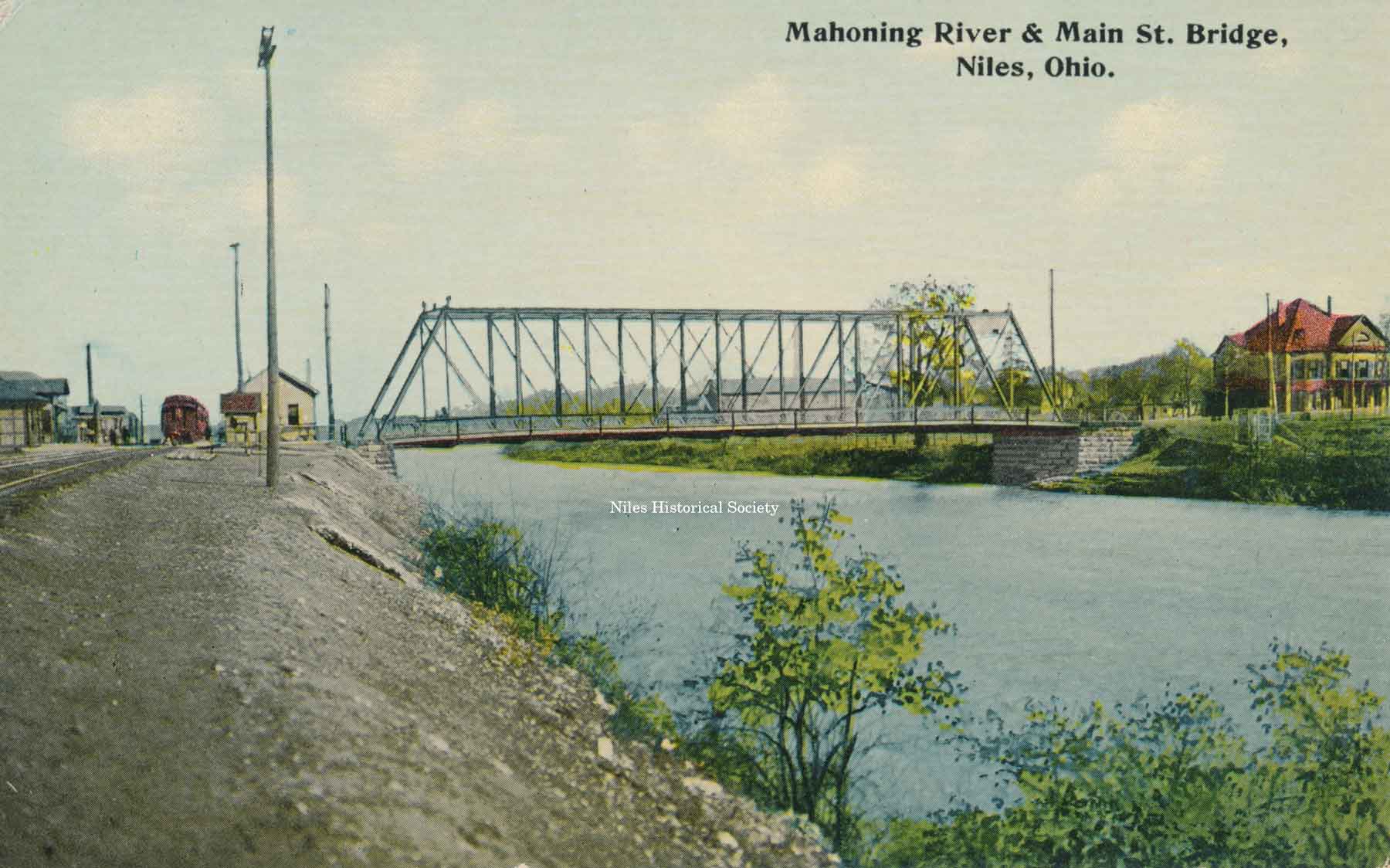
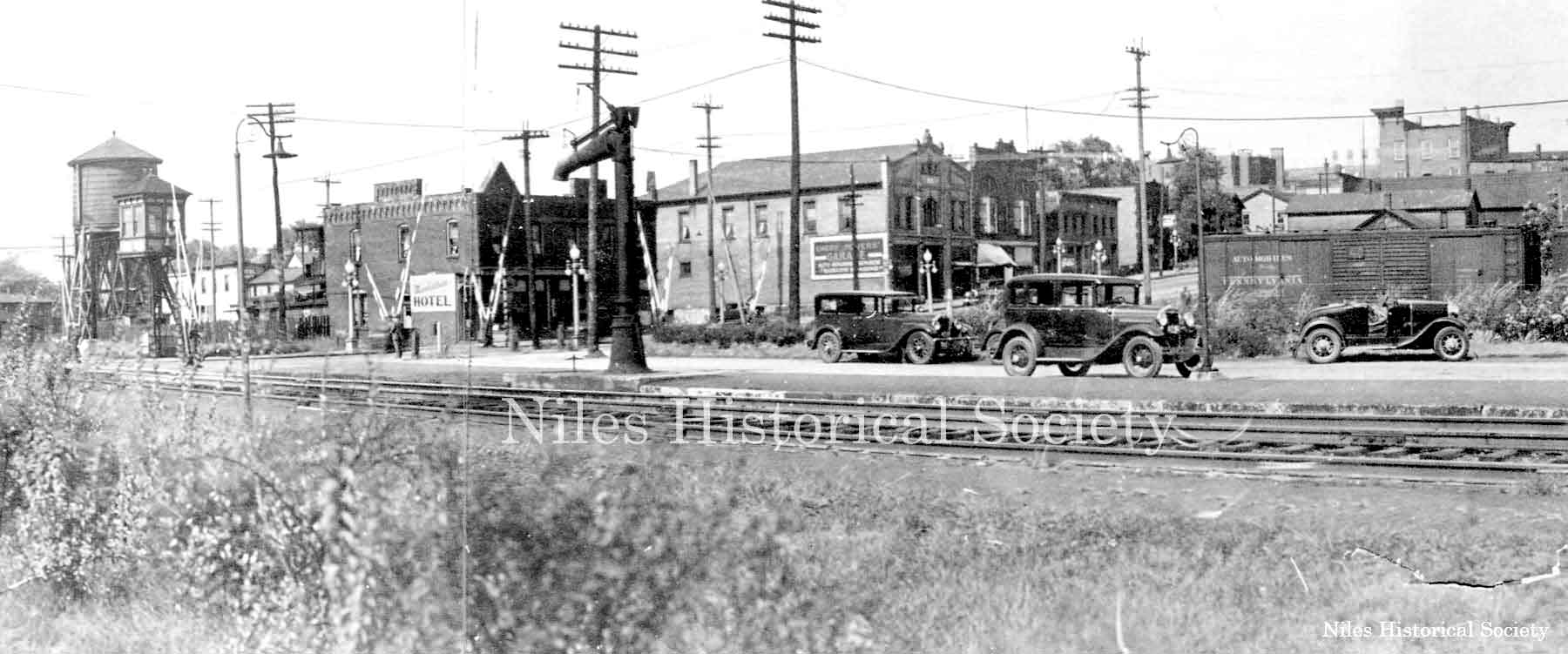
Viaduct Story. The Mahoning River in Niles had been spanned by many different types of bridges. First a wooden covered bridge was constructed, next an iron bridge which was supported by a stone pier in the middle of the river spanned the waterway. It was replaced by the iron bridge when high water washed one side away. The “Iron Bridge” built by Morse Bridge Company of Youngstown, in 1882 was replaced by the viaduct in 1933. The Iron Bridge was a flat steel bridge which spanned the Mahoning River. Main Street sloped down to the bridge beginning at State Street and past Water Street. On the South Side, First Street was level with the bridge.
|
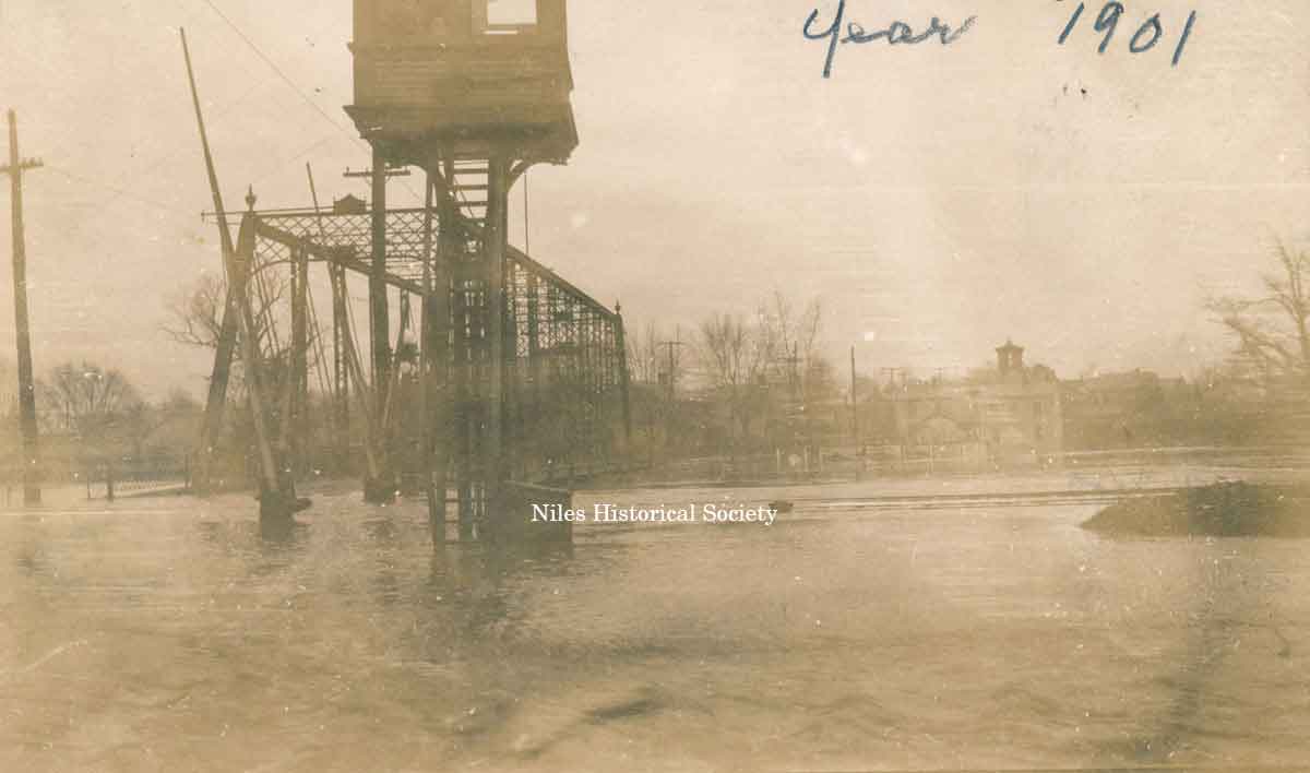 |
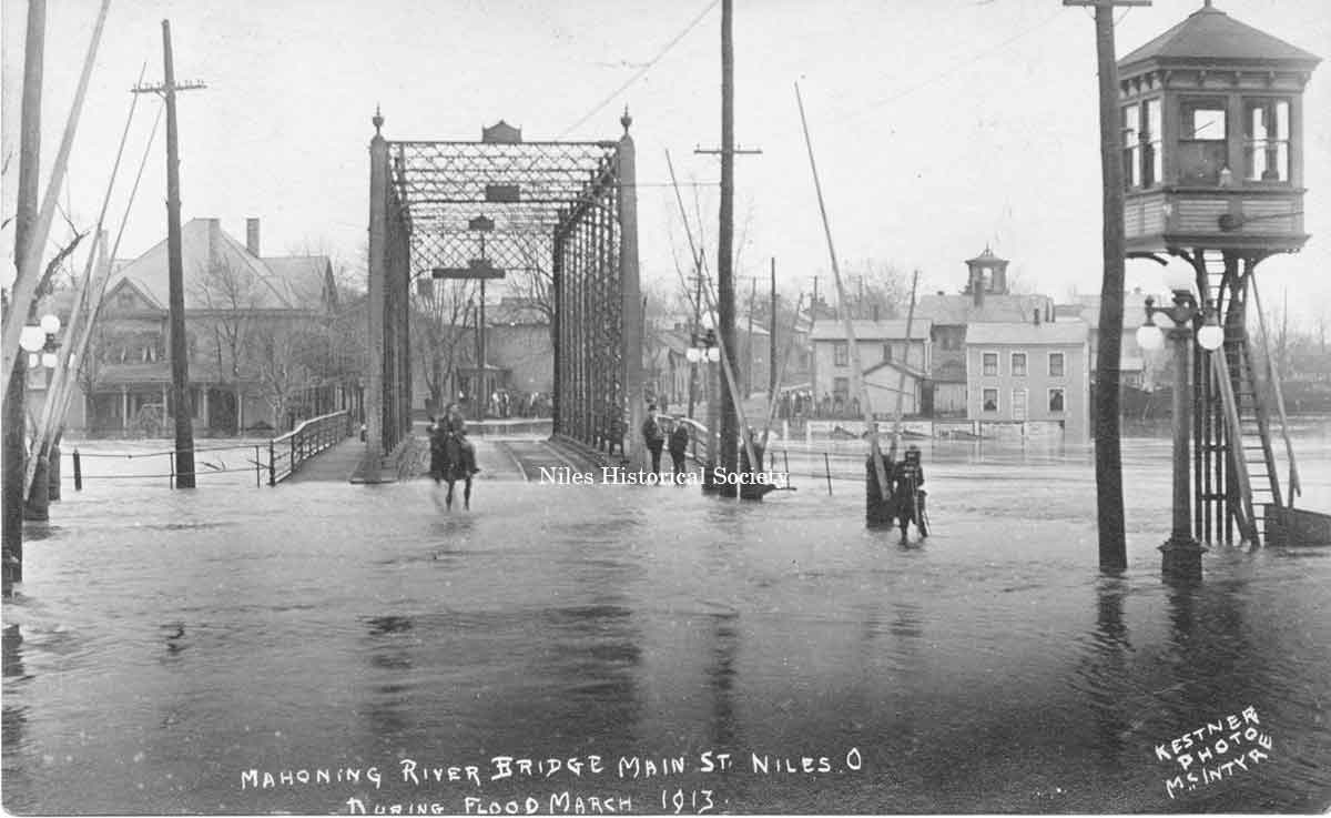
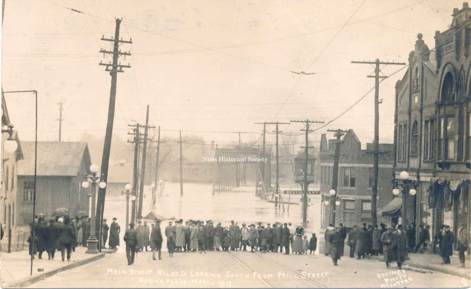
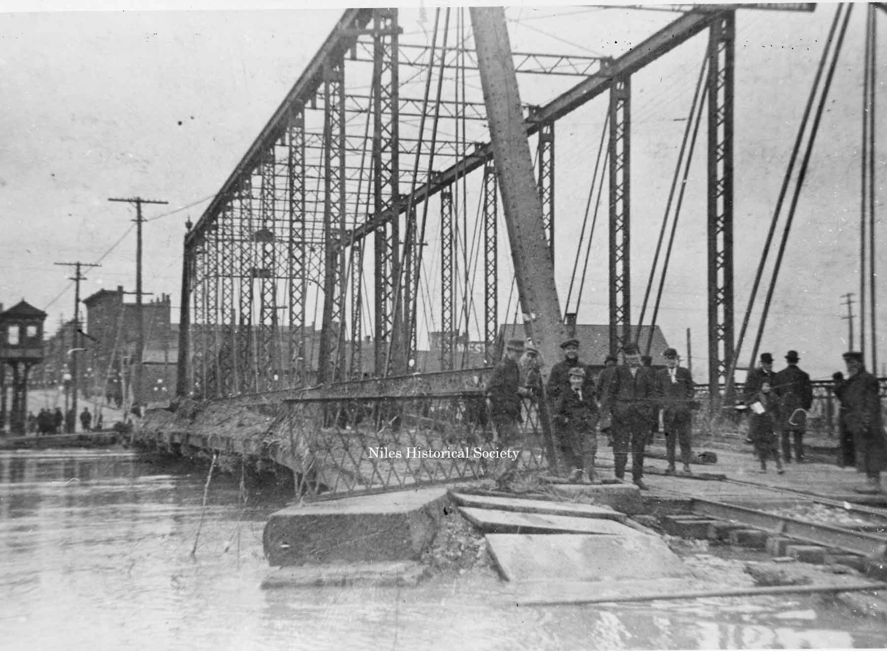
Mahoning River Floods–1901 and 1913. There had been two major floods of the Mahoning
River (1901 and 1913) where the waters flowed over the Iron
Bridge. After experiencing the 1913 flood, the South Side Improvement
Club was formed to help promote construction of a new bridge
since the south side was frequently isolated from the rest of
the city by the rising of the Mahoning River. |
|
| |
||
South Main St. iron bridge was extensively damaged during the flood of 1913. |
View of Mahoning River looking south from Main Street during the Flood of 1913. PO1.1021 |
PO1.1025 |
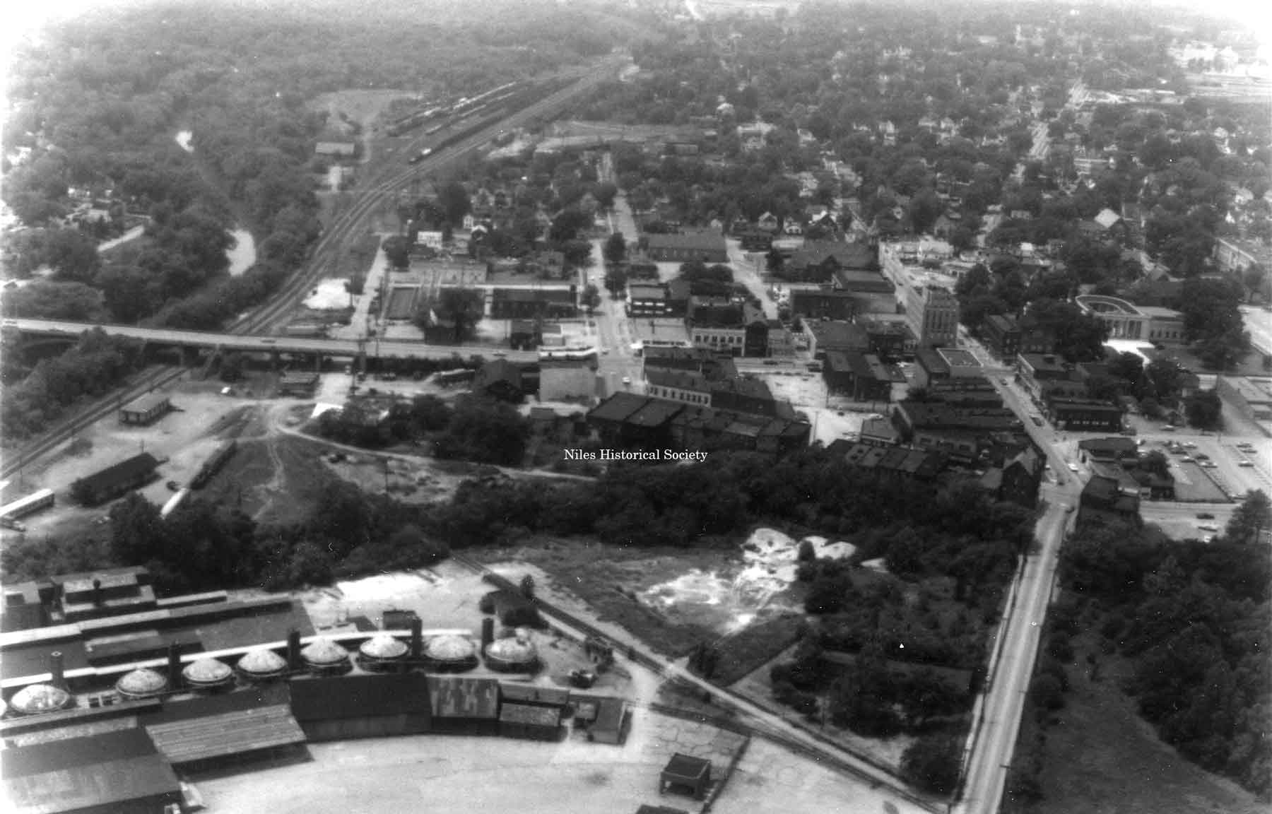
Aerial View of the Viaduct showing the Niles Firebrick kilns. ca 1962. PO2.474
View showing the PRR crossing at South Main Street
and Water Street. These railroad tracks were relocated nearer
the Mahoning River. |
Viaduct Project. The Nile Bridge project was first suggested some time prior to 1924. A consulting engineer was hired to estimate the cost of the bridge and assist the county engineer is preparing plans which were presented in 1926. Three prominent real estate men were appointed to make an estimate of the damage to the adjoining properties that in any way might be involved in the work of construction. The general plans were approved and adopted in 1927 and a permit was secured from the War Department for the construction of the bridge over the Mahoning River which was still classified as a navigable stream. The height and span of the planned viaduct would require the railroad tracks to be moved from their location near Water Street to a location closer to the Mahoning River. This relocation would require the purchase of several businesses located close to Water Street. Notices were served upon the property owners in April 1927 and they were notified to file their claims. The total cost of the bridge construction and settlement of property claims was $627,000. Damage claims began to be submitted and when all were filed there was a total of $$630,000 demanded by the property owners. This amount totaled more than that allotted for damage claims and the construction of the bridge. The buildings along both sides of Main Street would either be destroyed or access the new Viaduct with a higher entrance on the second floor. The Eagles Building is a good example of the height change that would occur in the viaduct construction. |
|
| |
||
|
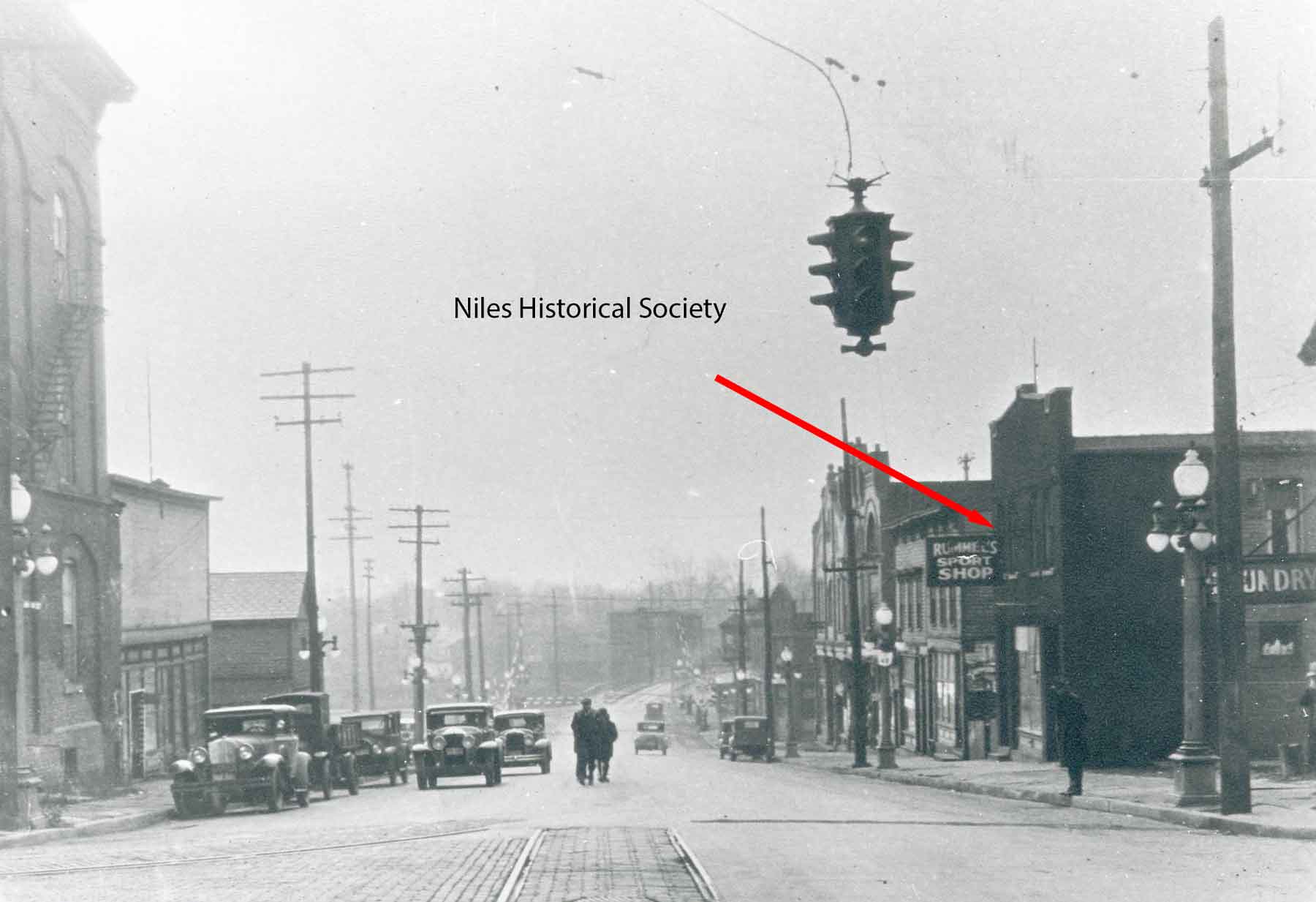
Looking down Main Street towards Old Iron Bridge which spanned the Mahoning River. Rummel’s Pool Hall is on the right hand side of the bridge marked by red arrow. The new viaduct replaced the Old Iron Bridge in 1933.
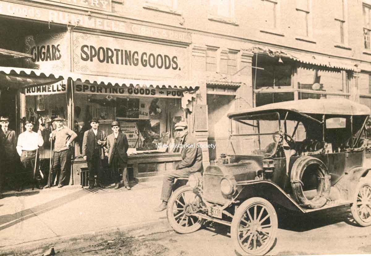
Close-up view of Rummel’s Pool Hall.
|
Main
Street Bridge Construction Has Been Delayed.
Niles Daily Times, June 30, 1930. Read the claims that are still unsettled: The properties involved are visible in the photograph below. Phoebe Nock, tax evaluation
$11,130, original claim $25,000; offered by the County Commissioners
in settlement, $5,500; still demanded $11,130.( John Andrews
Confectionary). Ira Thomas, original claim $15,000; offered by commissioners, $6,710; still demanded, $15,00;(Joe Rummel’s pool room). Tax evaluation, $15,140. Ellen Williams, original claim, $8,820; offered by commissioners, $4,200; still demanded, $8,280, (Dud Smith’s Tire Shop). Tax evaluation, $5,420. William and Ruth Near, original claim, $15,000; offered by commissioners, $6,500; still demanded, $7,000; tax evaluation, $8,950; (Near Self Service). Amelia Bashur, original claim, $35,000; offered by commissioners $7,500; still demanded, $35,000; (A&P Store on 2nd and Main on south side of Mahoning River). Tax evaluation $9200. “Study these figures, take a note of the property, and decide whether it is the County Commissioners or property owners who have held up the Niles Bridge Project. There has never been a time during all these years that the damage claims insisted upon, would permit the going on with the work. Not only that, but the commissioners and everyone in any way connected with the work have been subject to bitter and unjustified criticism. This is why this plain statement of facts has been made to the public. I, with the others involved, have kept out of print and attempted no public justification, but recent attacks through the press compels us to give out the truth”. Homer E. Chinnock aka Harry Chinnock. His name appears as one of the county commissioners on the bronze plaque below labeled. |
|
|
|
||
|
On September 16, 1932 the first load of material arrived for the construction of the Viaduct. 843 tons of steel, 300,00 red bricks, and 16,200 barrels of cement would be used in the bridge construction. On September 19, work started on the temporary bridge and it was opened October 20th, at which time, this old iron bridge was torn down. A temporary bridge, seen under arch, was placed over the Mahoning River connecting First Street on the South Side to Arlington on the north side to allow traffic to cross while the new Viaduct was being built. This span was removed once the Viaduct opened to foot and vehicle traffic. The new Viaduct was dedicated on October 28, 1933.
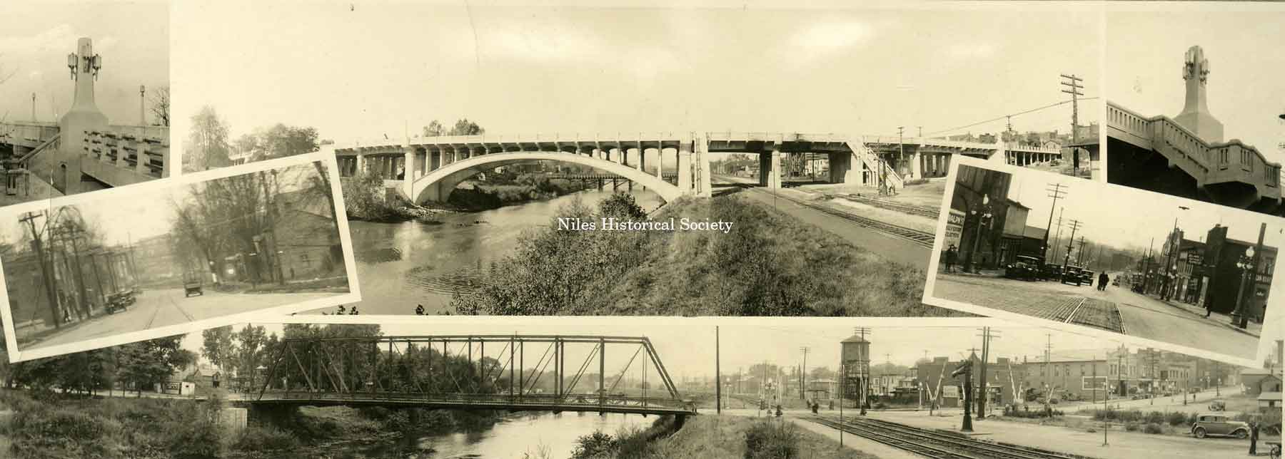
A postcard of several views of the South Main Street Viaduct right after it was built. Two additional views of Main Street downtown and of the old bridge over the river. PO2.627 |
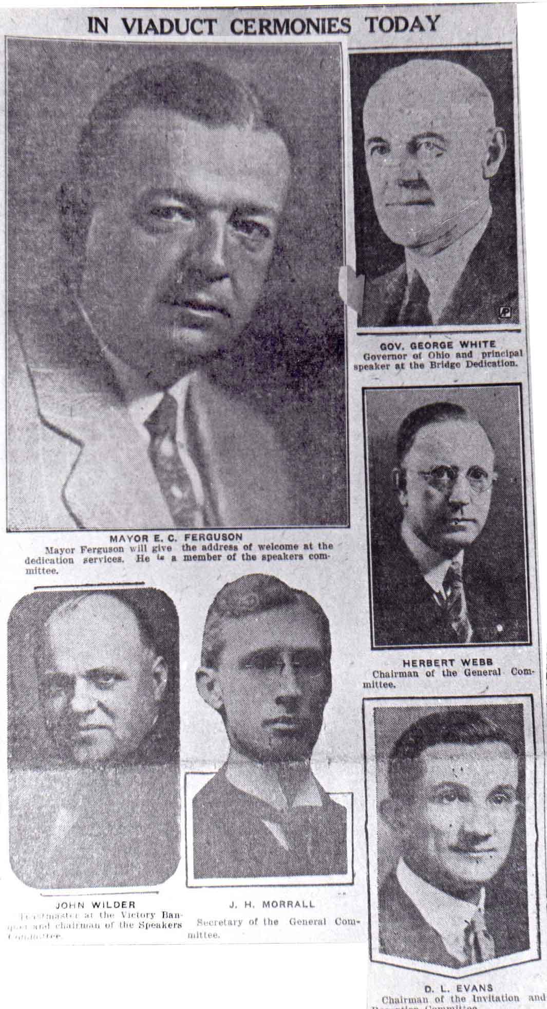
Photograph of article appearing in newspaper of the official opening of the viaduct, October 28, 1933. Gov. G. H. White spoke at the dedication held in the high school auditorium; Jean Lally presented flowers to the Governor and opened the bridge to traffic. Mayor E. C. Ferguson gave the opening Speech of Welcome. PO1.71 |
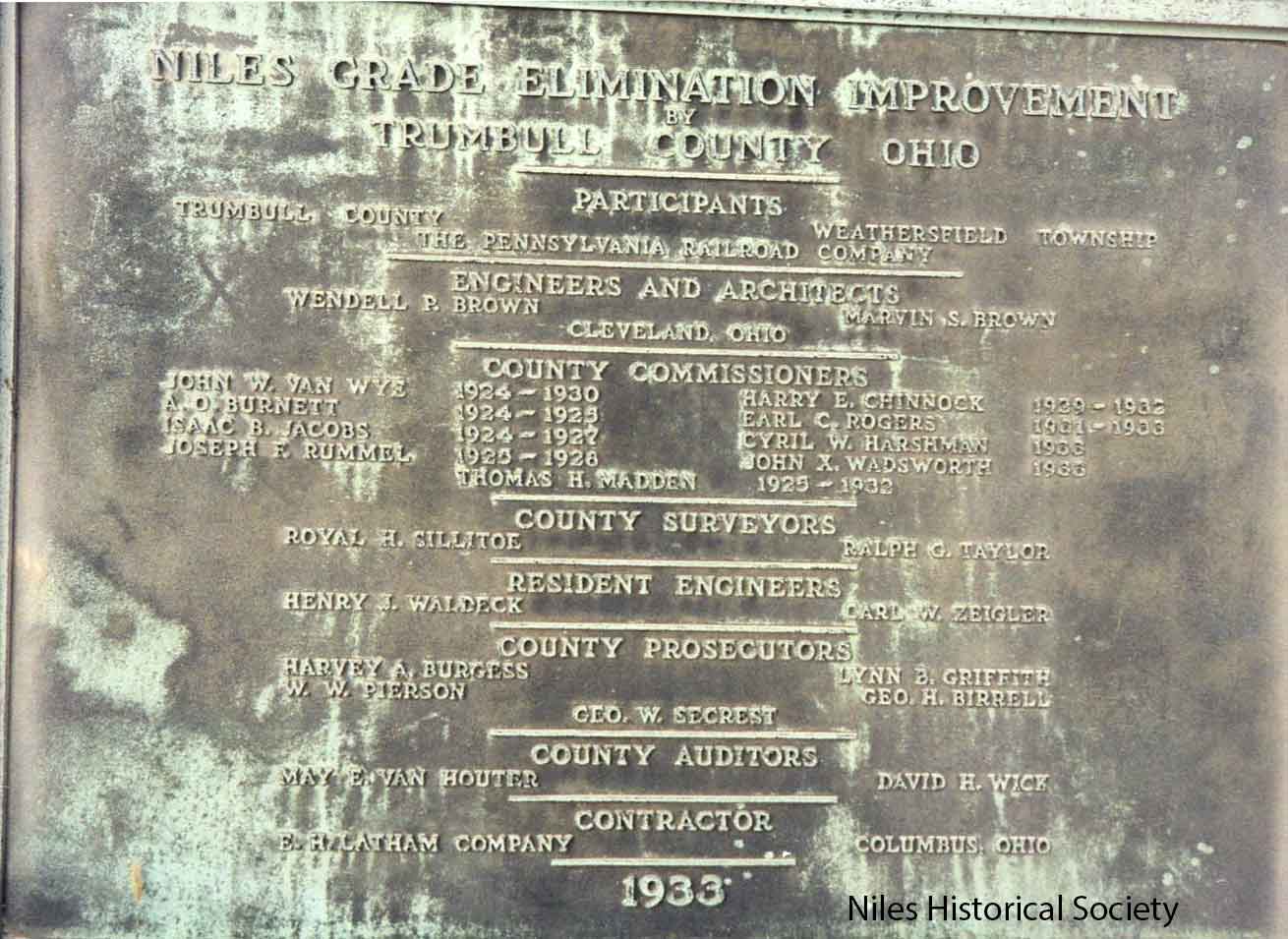
The brass plaque that adorned the 1933 viaduct over the Mahoning River. It was taken down during the 2002 re-construction. PO2.409
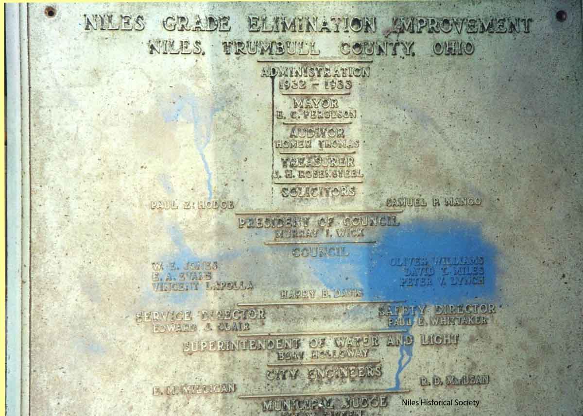
The brass plaque, with city officials names, that adorned the 1933 viaduct over the Mahoning River. It was taken down during the 2002 re-construction. PO2.409a |
|
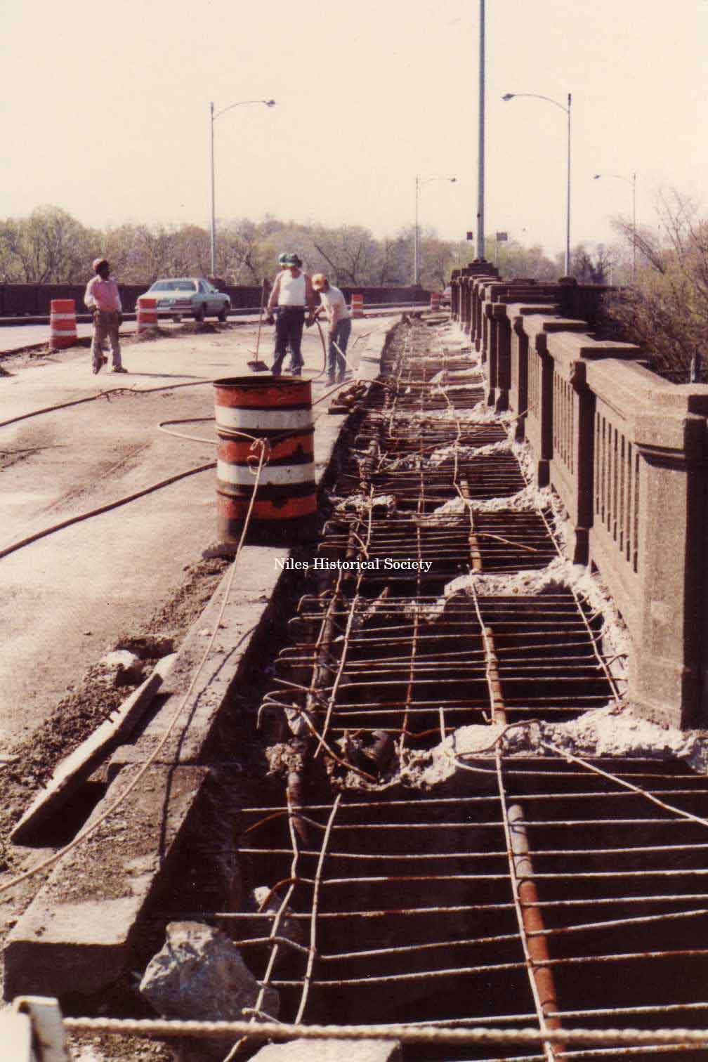
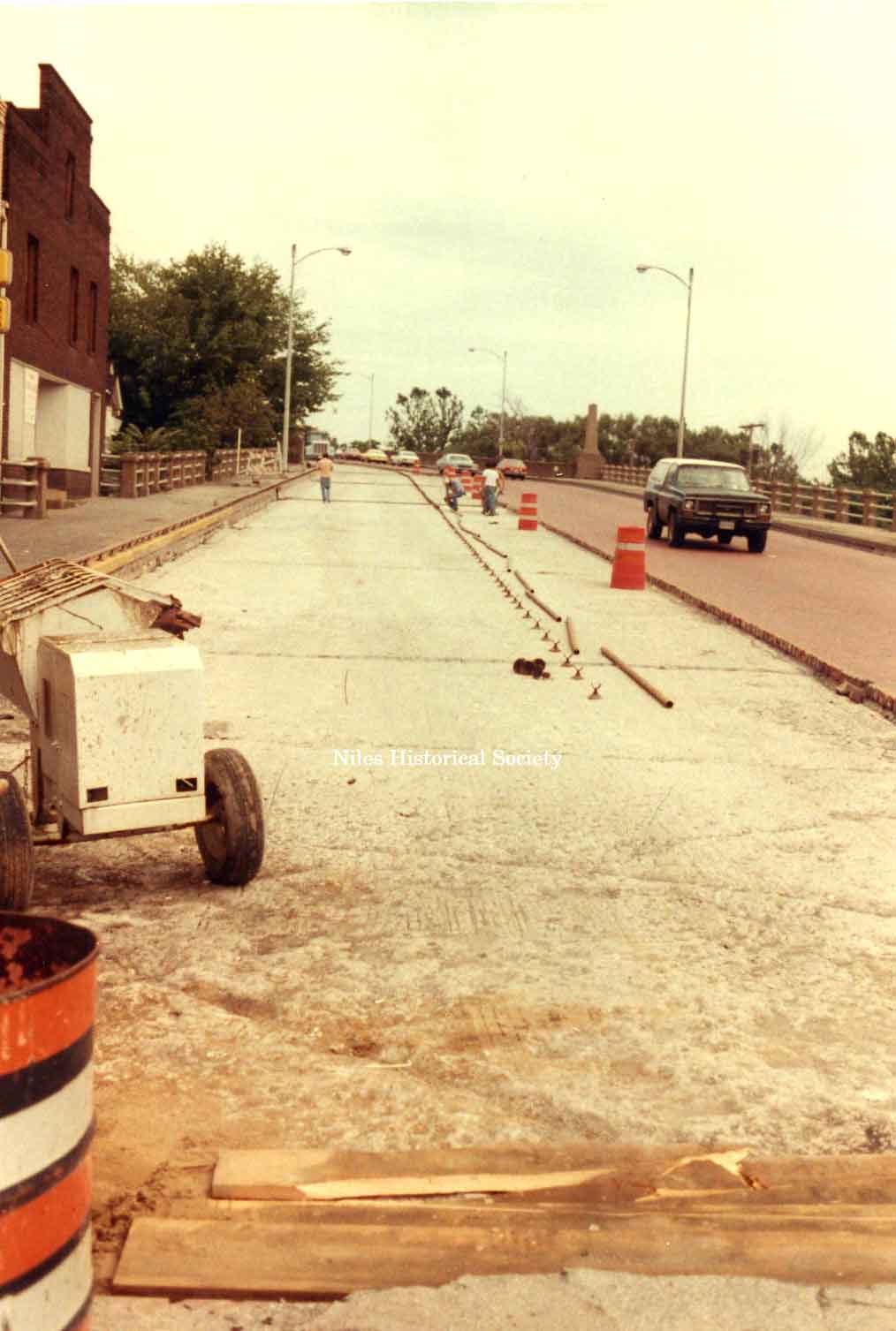
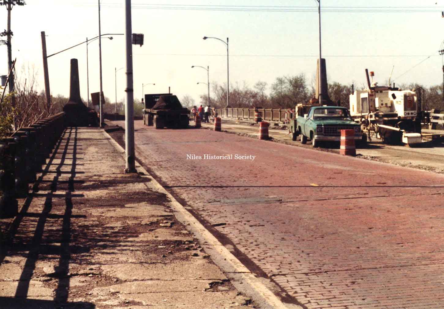
In 1981, the deterioration of the 1933 bridge structure necessitated that repairs be made to the sidewalks and road surface. The deterioration of the bridge stairway structure that made the renovation essential. The crew worked on one side of the bridge at a time so that traffic remained open. PO2.409b |
1981 picture of the renovation of the Main Street Viaduct. The sidewalks were removed and repairs were made to the substructure, then new concrete was poured. PO1.73 |
Picture taken of the Main Street Viaduct during the 1981 renovation. At this time, the 1933 paving bricks were removed and replaced with concrete. PO1.85 |
|
1981 Renovation |
1981 Renovation |
1981 Renovation |
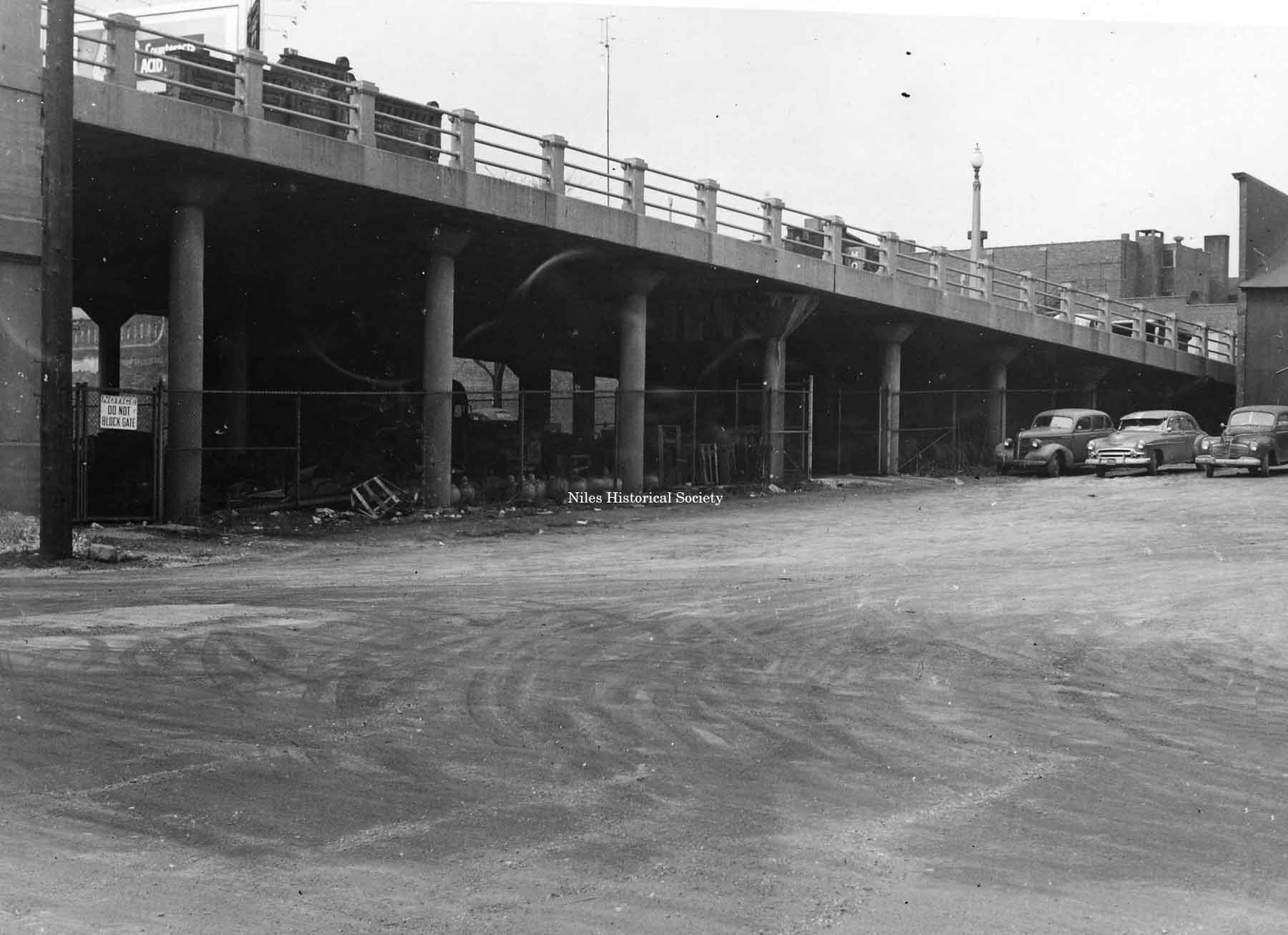
The area underneath the 1930's viaduct over the railroad tracks and Mahoning River has long been used as a storage area by the city. Photo ca 1950. PO2.536 |
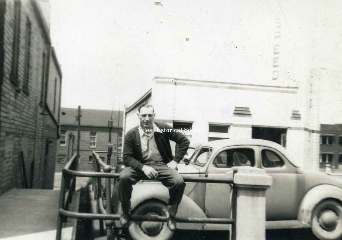
The iron rails of the Viaduct provided great seating as shown in this 1950s photo. The Daily Times Building is in center back and the City Building is in right back. Person unknown. PO2.723 |
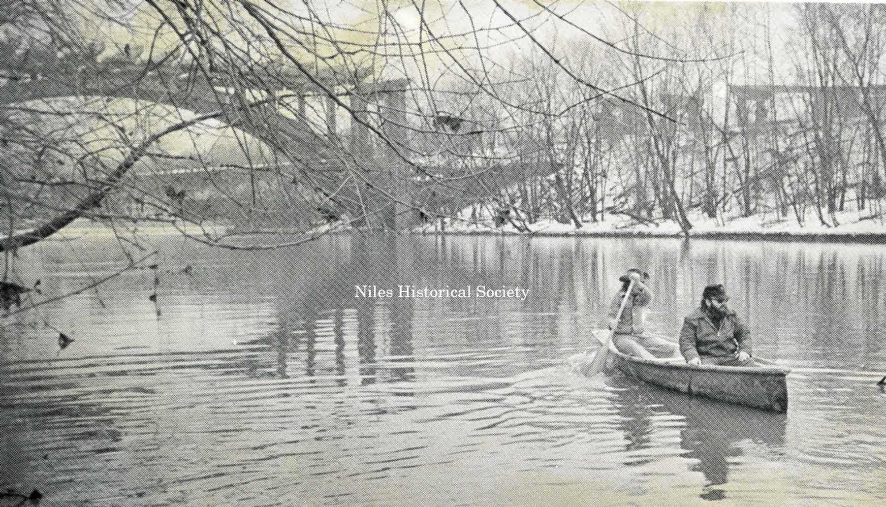
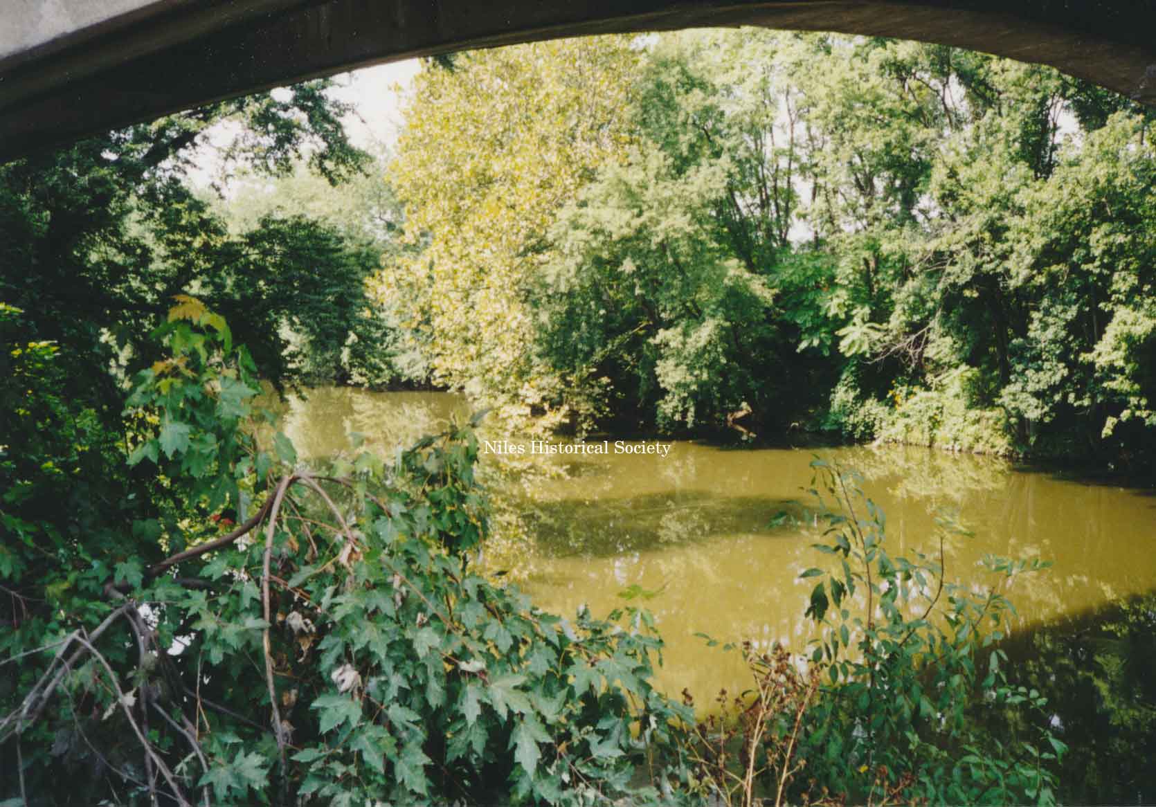
After years of chemical dumping of wastes by the steel mills that polluted the Mahoning River, the contaminated waters are being cleaned up by two forces–the EPA restrictions which control the waterways and the economics that caused many of the steel mills to be shut down. PO9.26 |
|
|
|
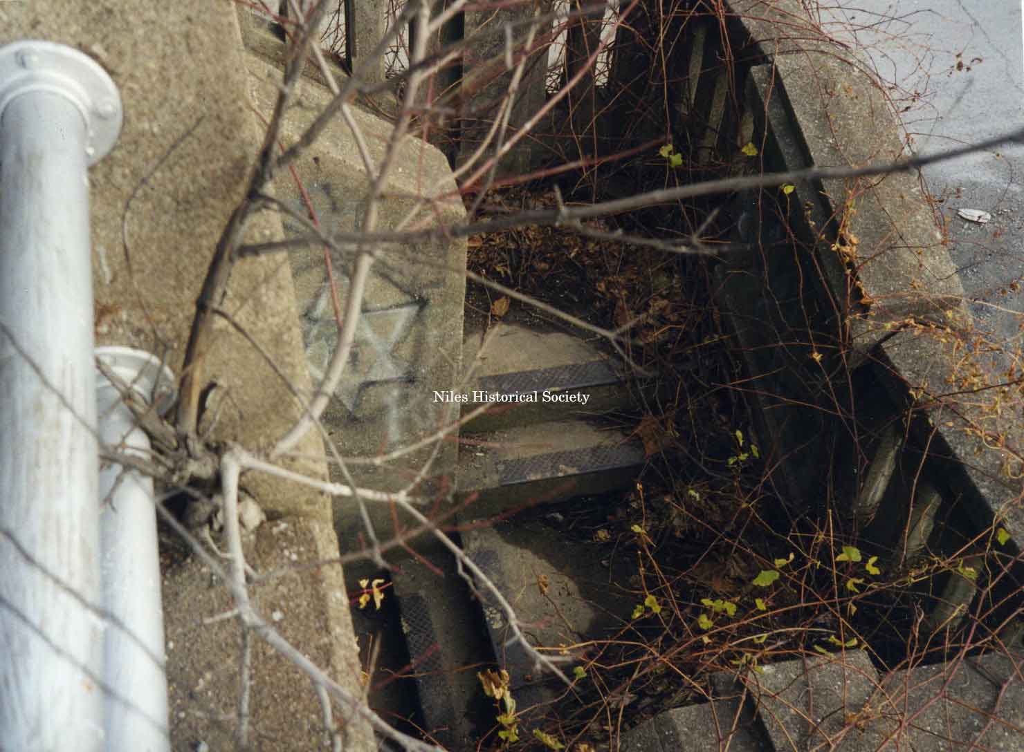
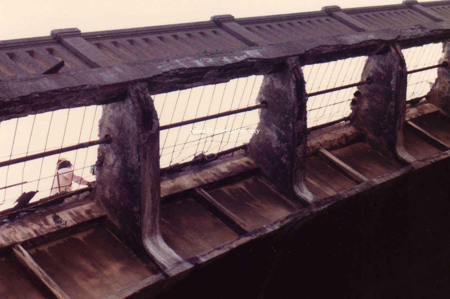
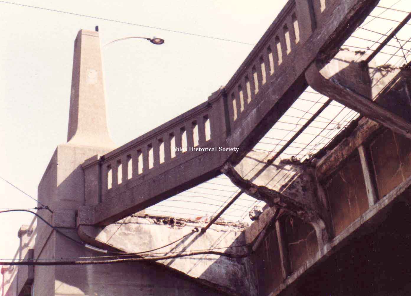
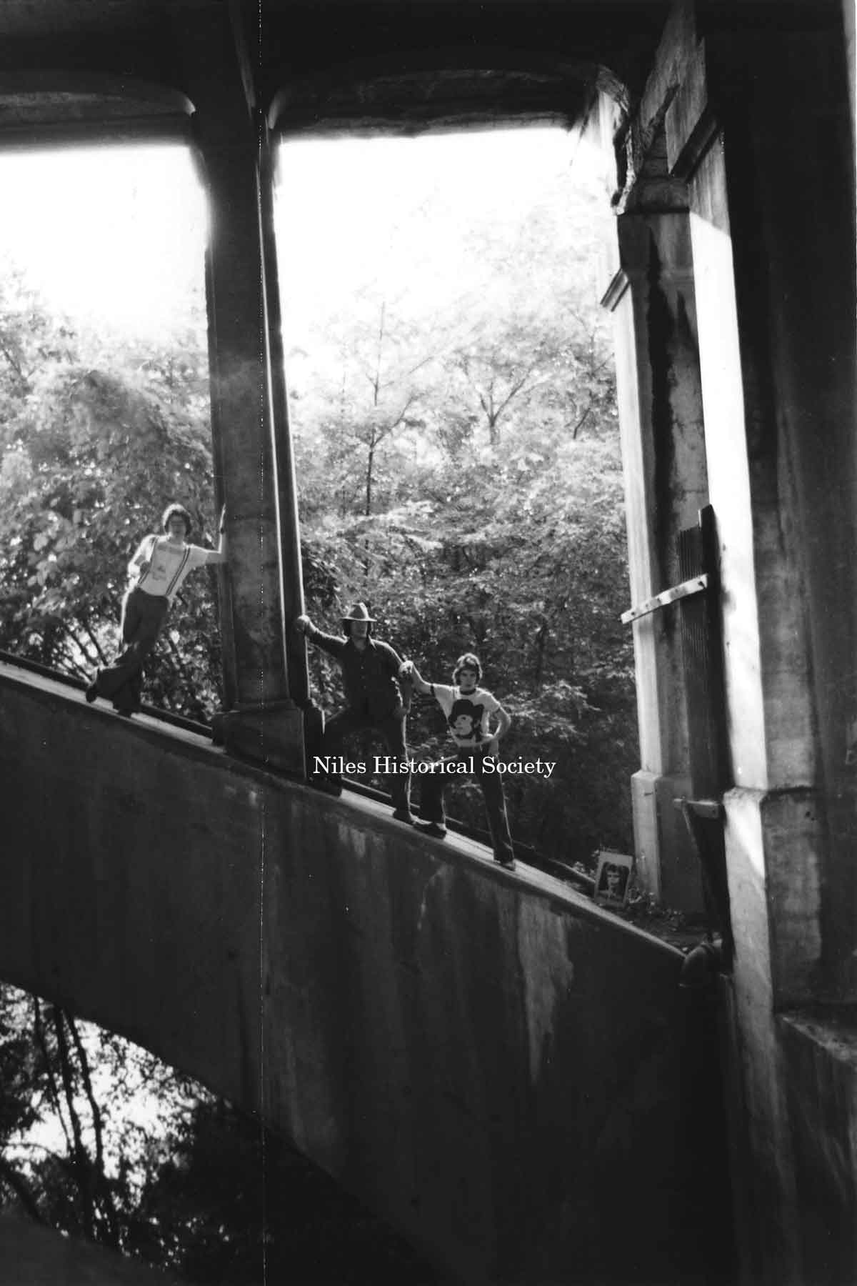
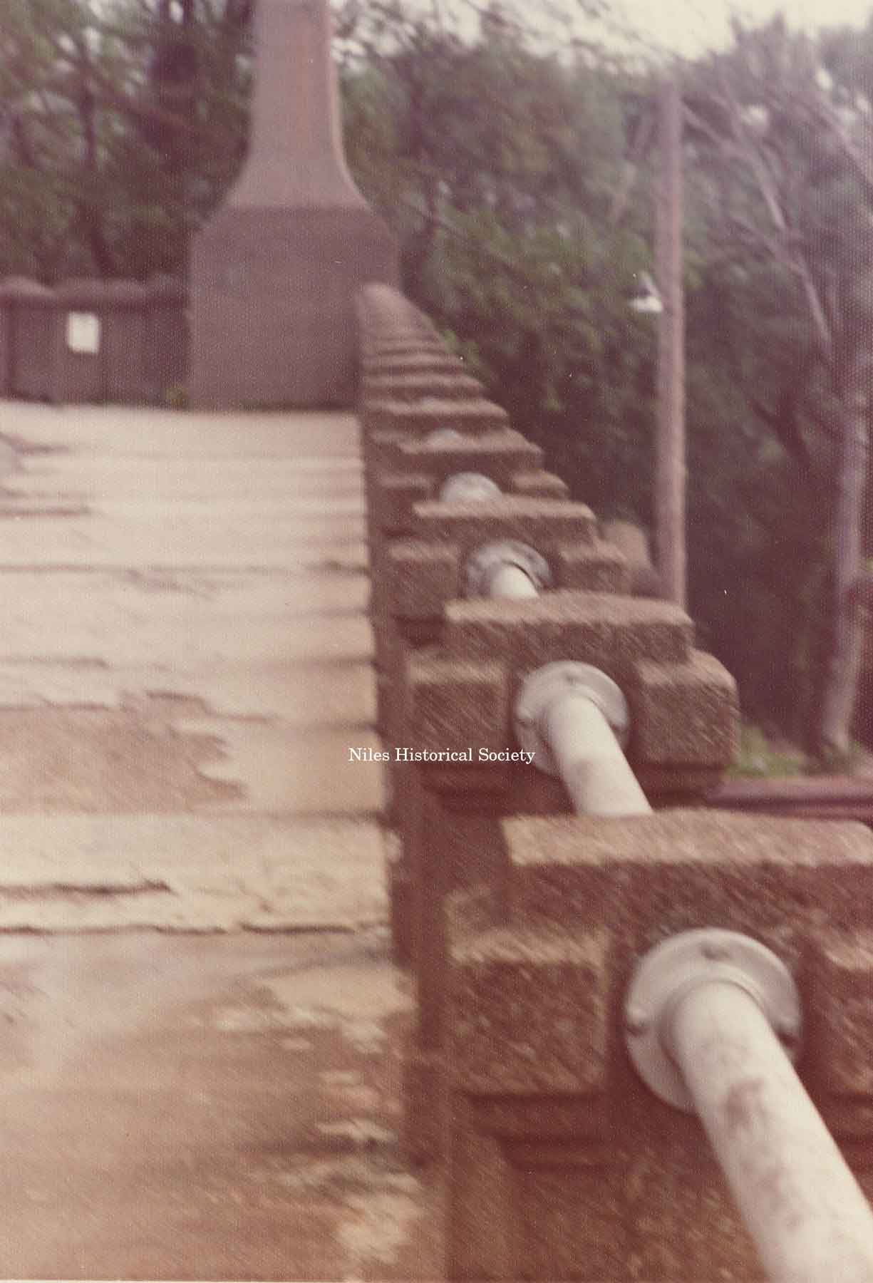
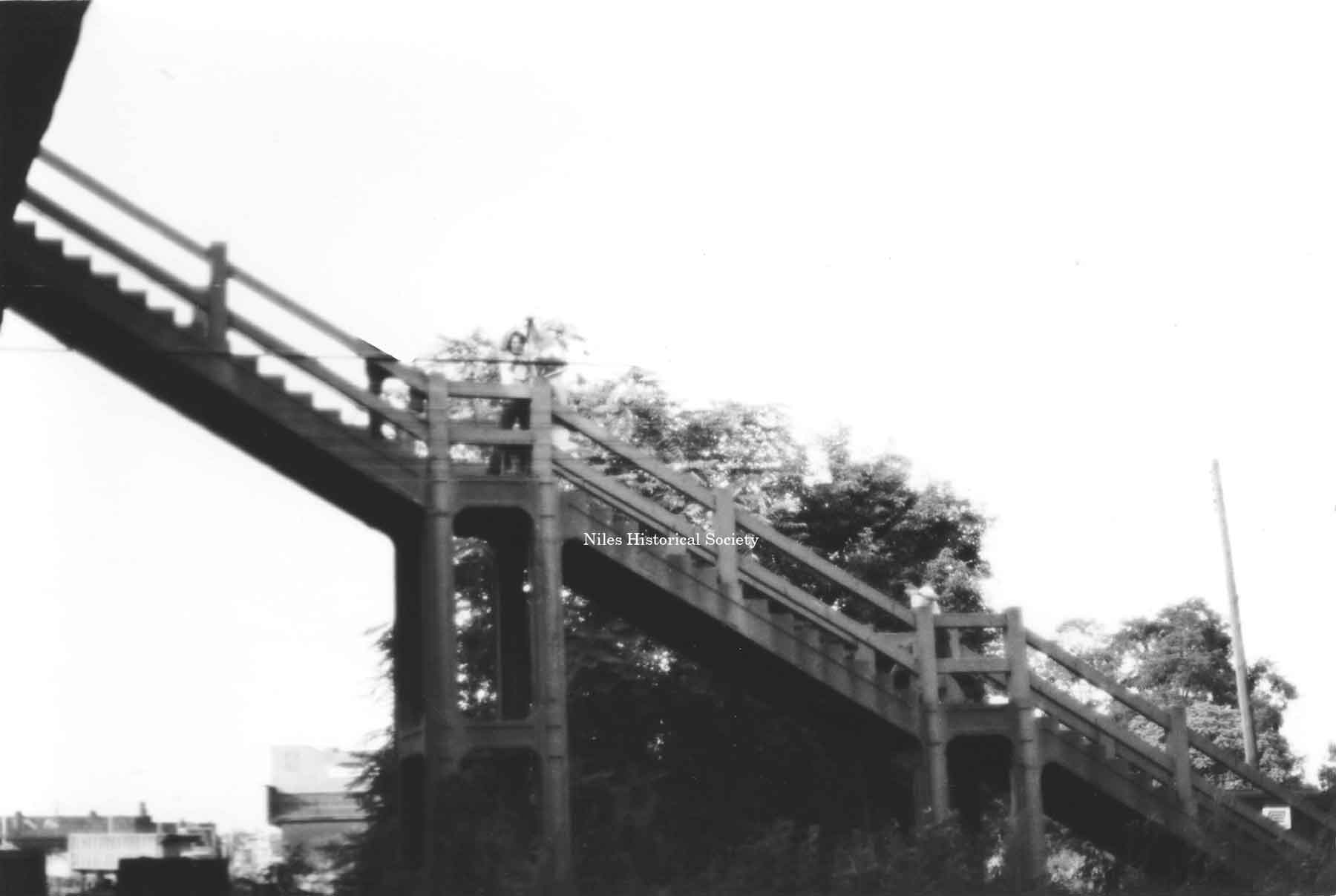
Three images of the bridge from 1974. The arches under the Viaduct are visible and many students recall the challenge of crawling over the arches. John Burns, Glen Laraway and John Norman shown in arch. The deterioration of the 1933 cement side walks and the piers holding the safety bars. View of stairsteps from bridge level to ground level which were a part of the 1933 bridge. |
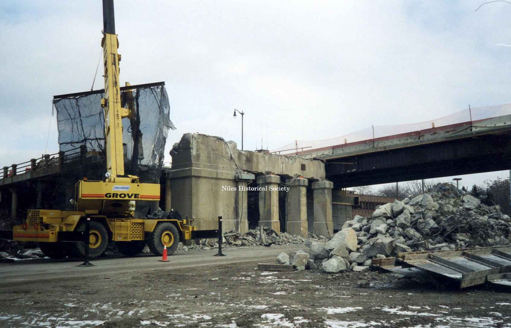
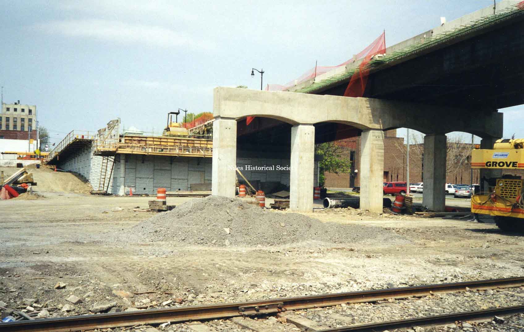
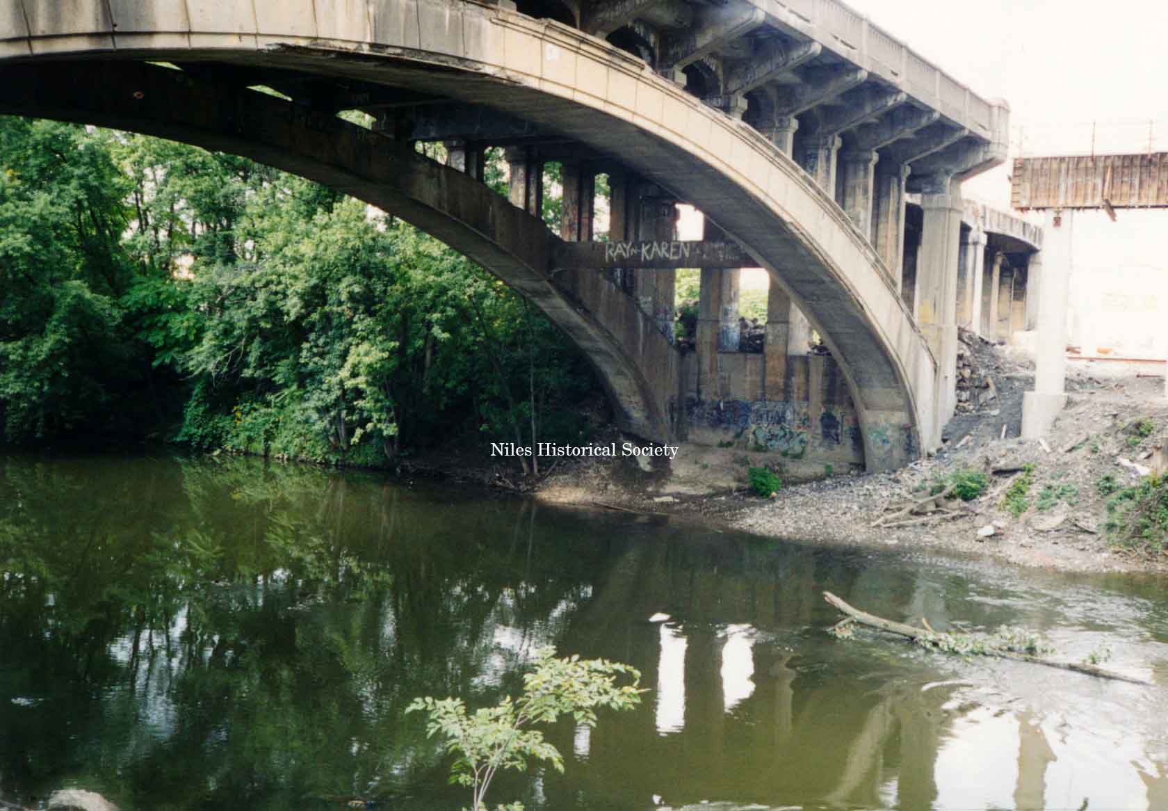
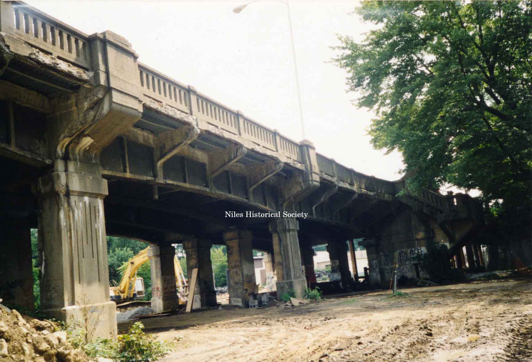
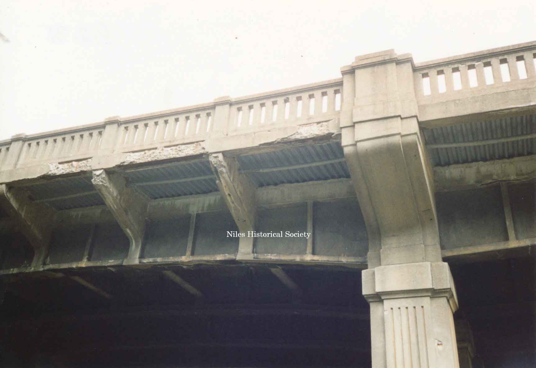
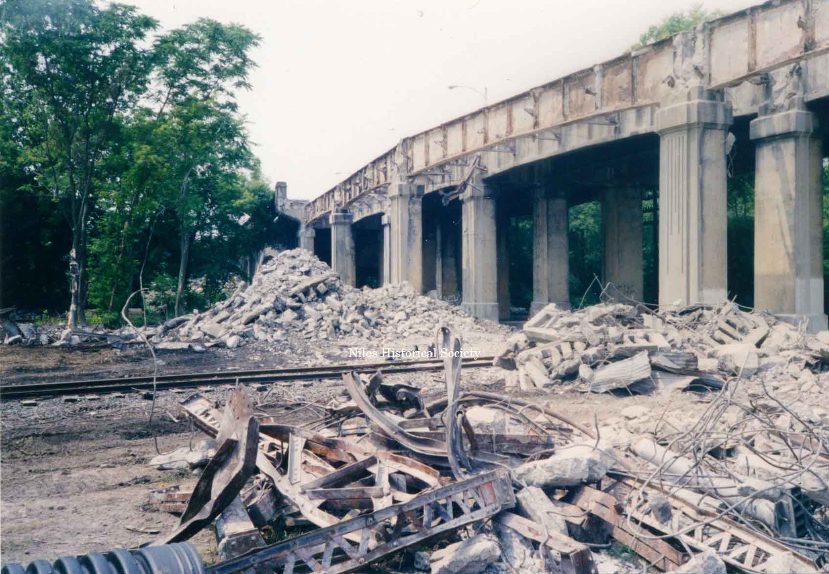
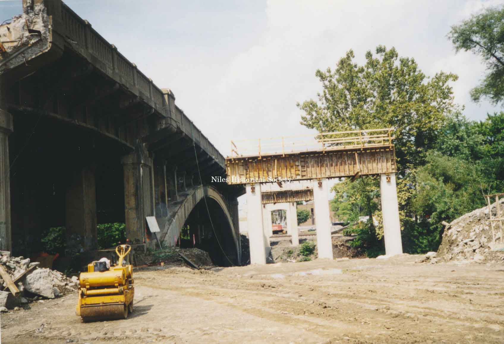
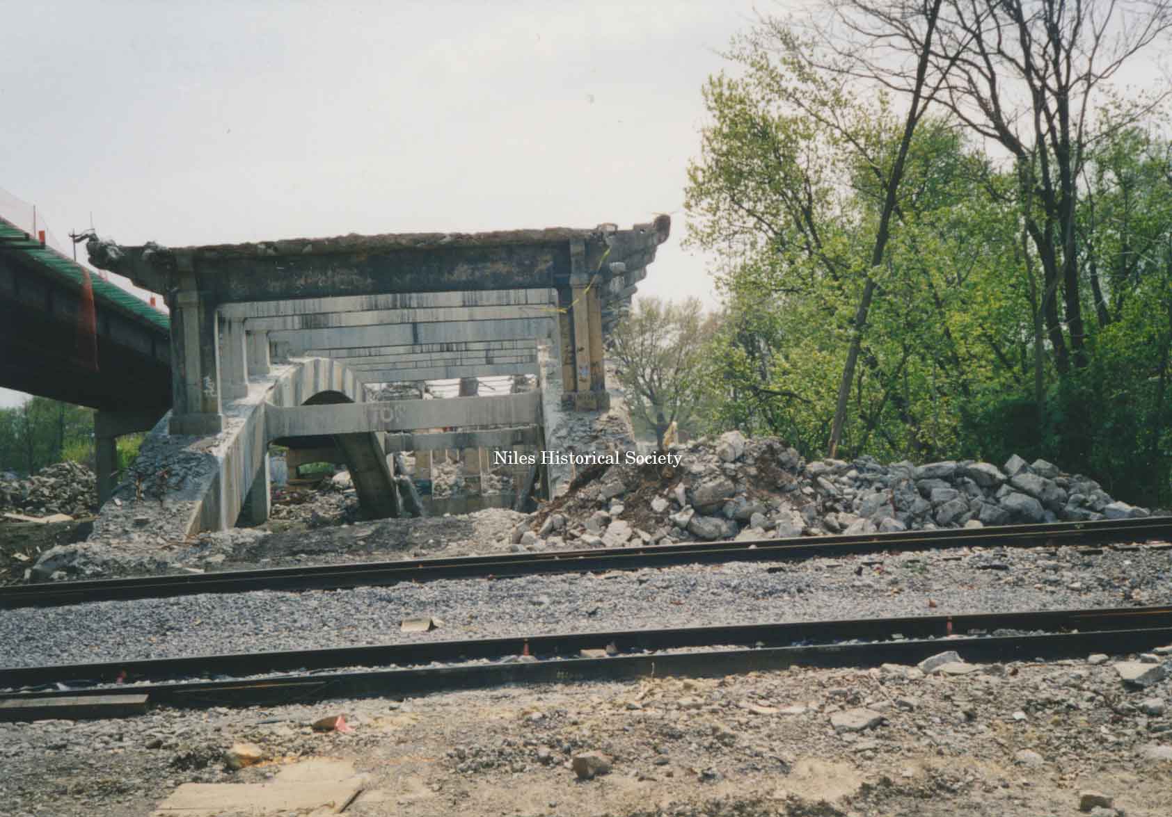
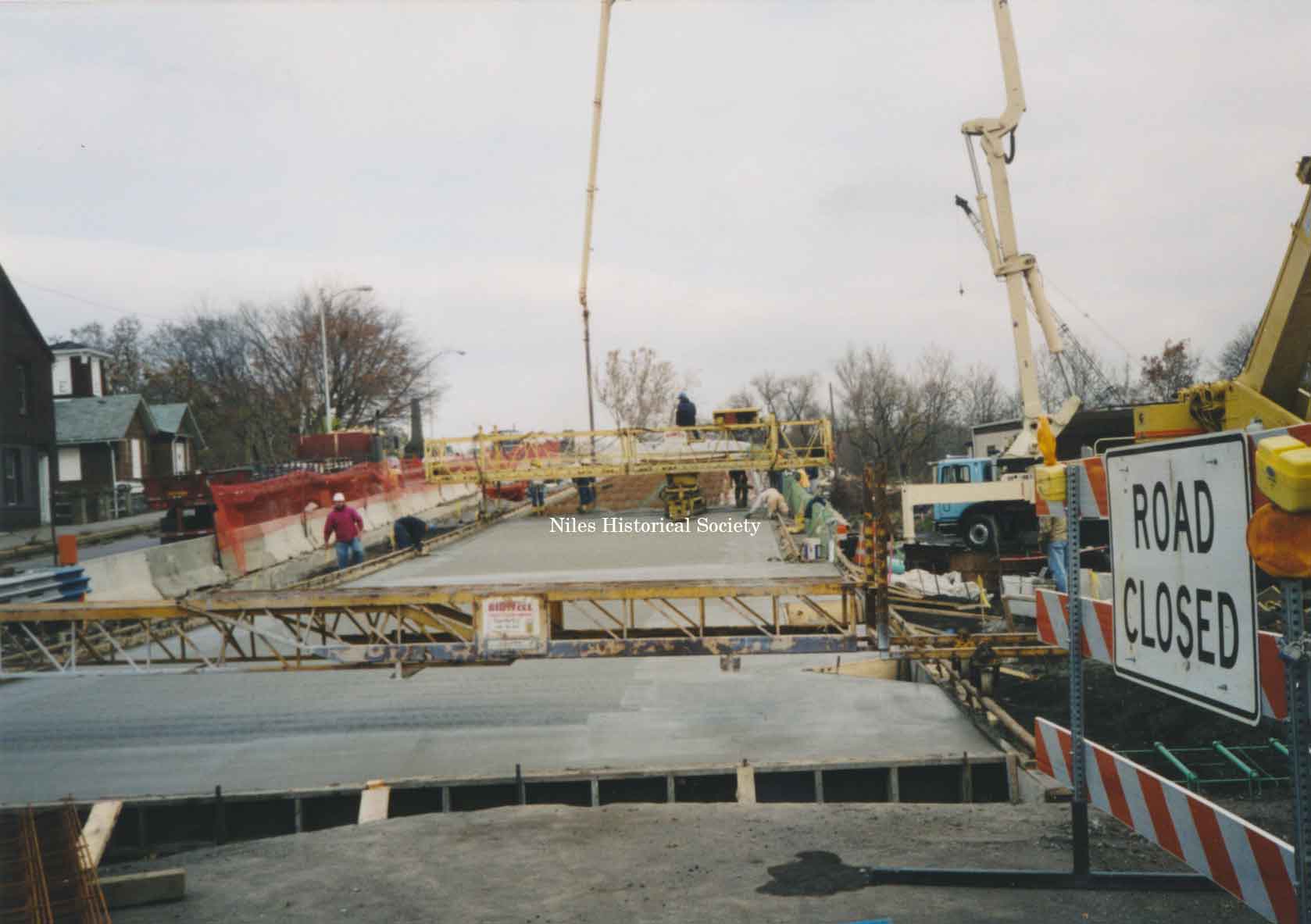
| Viaduct Rebuilt-2001. Again in 2001, the viaduct underwent extensive repairs with a complete teardown of the entire structure. New support piers, sidewalk and roadway replaced any remnants of the original 1933 Viaduct. The destruction and rebuilding of the Niles Viaduct connecting the south side of the city to the downtown area took place over a period of two years from 2001–2003. |
PO3.529 |
PO3.529.19 |
These photographs are different views of the demolishing of the main Street viaduct over a period of two years from 2001–2003. |
 |
 |
 |
 |
 |
 |
 |
 |
| |
||
|
|
||